| |

|
|
|
| |
 Cade Street in East Sussex lies one mile east of Heathfield,
on the B2096.
This place gets its name from one Jack Cade , who,
in 1450, organised the Kentish Rebellion . He lead an
army of insurgents to London, where they beheaded
the Treasurer, Lord Saye. Cade Street in East Sussex lies one mile east of Heathfield,
on the B2096.
This place gets its name from one Jack Cade , who,
in 1450, organised the Kentish Rebellion . He lead an
army of insurgents to London, where they beheaded
the Treasurer, Lord Saye.
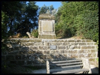
A roadside monument stands just north of the Battle
road, announcing that Jack Cade , rebel, was killed
here by Alexander Iden, Sheriff of Kent( see Iden ).
Cade did not actually die here, but was found mortally
wounded in a nearby garden, and died on the way to
London, where his head was fixed upon London Bridge.
It is possible that Jack Cade was killed at Hothfield
near Ashford , and that Cade Street was named in error.
(See also our Jack Cade page)
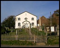
Also to be found in Cade Street , is the Independant
Chapel. Built in 1767 it is a simple symetrical
building with an oval window over its south facing porch.
(Our thanks to Alf Rogers for the following details) The Independent Chapel at Chapel Cross was always considered
a part of Punnetts Town in my time. My father is buried in the
Chapel grounds. Incidentally, the chapel was known locally for
many years as 'The Chocolate Church' from a habit of the Pastor,
one PJ Pont, to distribute those delicacies to the children
attending Sunday school.
Inside the Chapel, and decorating headstones in the
churchyard are several very attractive relief plaques
of terracotta. These were made in the early 19th
century by Jonathan Harmer of Heathfield . The colours
of the plaques vary from cream to red, and feature such
designs as cherubs, vases and baskets of fruit.
The terracottas can be seen in several churchyards in
the Heathfield area, and there is a small exhibition
featuring them in the Anne of Cleves House museum in
Lewes. |
|
 If you park in the Chapel car park on the Battle road
then look south the downs at Eastbourne are visible,
in all their splendour. If you park in the Chapel car park on the Battle road
then look south the downs at Eastbourne are visible,
in all their splendour.
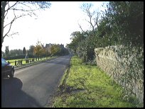
Park in the village, by the village green and war
memorial. Walk back to the main road and then along
the main road towards Heathfield . To the north of you
is the valley with Broad Oak and the Heathfield Horse
Racing track in the distance. |
|
 Cade Street in East Sussex , as it is only about 2 miles from Heathfield
has very few services, with the majority in the town
centre. Cade Street in East Sussex , as it is only about 2 miles from Heathfield
has very few services, with the majority in the town
centre.
An infrequent bus service from Battle to Heathfield
passes through the village.
The nearest train service is in Stonegate about 7 miles
north east, or Wadhurst about 7 miles North, both on the
London Hastings line, which provides 20 minute services
in the rush hour, and hourly in between. |
|
| Cade Street is shown as the red symbol on the map. |
|
|
Nearby Villages
(click on symbol to see the village page) |
| Village= | |
Town= | |
Recorded in Domesday= |  |
| |
|
|
Ashburnham |
(Last Iron Furnace in Sussex) | | 6.20 miles |
|
|
Blackboys |
(Charcoal and Soot) | | 5.89 miles |
|
|
Bodle Street |
(White Horse on the roof) | | 4.47 miles |
|
|
Brightling |
(famous for Mad Jack Fuller) | | 5.04 miles |
|
|
Broad Oak |
(Smallpox at the Academy) | | 0.78 miles |
|
|
Burwash |
(The home of Rudyard Kipling) | | 5.09 miles |
|
|
Burwash Common |
(Roughest pub in the South East) | | 2.79 miles |
|
|
Burwash Weald |
(Roughest pub in the South East) | | 3.21 miles |
|
|
Buxted |
(The first Iron Cannon in England) | | 6.82 miles |
|
|
Cross in Hand |
(The Crusaders Assembly) | | 2.68 miles |
|
|
Dallington |
(Custers Last Stand!) | | 3.50 miles |
|
|
East Hoathly |
(Another Sussex Cannibal?) | | 5.91 miles |
|
|
Etchingham |
(The oldest Brass Weather Vane in the country) | | 7.39 miles |
|
|
Five Ashes |
(Vast collection of rock plants) | | 3.78 miles |
|
|
Hadlow Down |
(Wealden Cannons and Charcoal) | | 4.81 miles |
|
|
Halland |
(Ancient Slaughter) | | 6.97 miles |
|
|
Heathfield |
(19th Century Natural Gas) | | 1.20 miles |
|
|
Horam |
(Which Station do we get off at ?) | | 2.91 miles |
|
|
Mayfield |
(Saint Dunstan and the Devil) | | 3.87 miles |
|
|
Netherfield |
(Village at the top of the Hill) | | 6.72 miles |
|
|
Penhurst |
(Beautiful yet Remote) | | 6.29 miles |
|
|
Punnetts Town |
(The Windmill on the Hill) | | 1.64 miles |
|
|
Rushlake Green |
(Open Village and Nuclear Bunker) | | 2.16 miles |
|
|
Vines Cross |
(Cannons and Doodlebugs) | | 2.16 miles |
|
|
Waldron |
(Fullers Earth) | | 3.62 miles |
|
|
Warbleton |
(The Iron Man) | | 1.81 miles |
|
|
| Copyright Villagenet 1998-2025 | |
| |
|
|
Local Interest
Just click an image |
|
|
|
|
|
|
|
|
|
|
|
|
|
|
| |