| |

|
|
|
| |
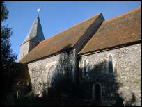
 East Blatchington in East Sussex is nowadays a suburb of Seaford , but was originally
a village in its own right. It lies just off the coast road near to Seaford
and Bishopstone . East Blatchington in East Sussex is nowadays a suburb of Seaford , but was originally
a village in its own right. It lies just off the coast road near to Seaford
and Bishopstone .
The area was settled by the Romans probably as a port to transport goods
from the inland farms to Europe, the area was taken over by the Saxons
after the Romans left . The village originally ran from the church down
the hill to the duck pond.
In 1794 a very large barrack was built just north of the village by the
army, and was used extensively during the Napoleonic Wars . During its
early years,the soldiers were badly supplied, and 500 men from the Oxford
militia mutinied and occupied Seaford . The townspeople gave them their
provisions and alcohol, the following day the regular army based at the
fort in Newhaven overpowered the militia, and 25 mutiners were arrested.
The leaders were executed, and the others punished. The barracks were
left lightly manned throughout the 1800's and early 1900's , then became
a staging post for the soldiers fighting in France , who were shipped
from Newhaven . After the First World War the barracks were closed and
demolished.
In 1862 Henry Coxwell was invited by the British Balooning Association to
explore the heights of the atmosphere. Together with a Dr James Glaisher
they ascended to 26,000ft and kept climbing where upon Glaisher became
unconcious due to the cold and lack of oxygen, Coxwell whose hands had
frozen opened the release valve with his teeth and both men safely
descended to earth. |
|
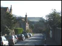
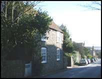
 The old high street , known as Blatchington Hill is quite attractive
as the buildings are quite old, and Seaford Head and the downs lie
at the end of the view. The old high street , known as Blatchington Hill is quite attractive
as the buildings are quite old, and Seaford Head and the downs lie
at the end of the view.
The views from Seaford and the coastline are very pretty. |
|
 East Blatchington in East Sussex has no services as such, but is provided with the
range of services in Seaford . East Blatchington in East Sussex has no services as such, but is provided with the
range of services in Seaford .
The nearest large shopping centre is at Newhaven about 3 miles west.
Trains are available from nearby Seaford . |
|
| East Blatchington is shown as the red symbol on the map. |
|
|
Nearby Villages
(click on symbol to see the village page) |
| Village= | |
Town= | |
Recorded in Domesday= |  |
| |
|
|
Alciston |
(Fifty thousand tiles on the Barn) | | 3.87 miles |
|
|
Alfriston |
(Smuggling and Ghosts) | | 3.20 miles |
|
|
Berwick |
(Sharpen your arrows on the Church) | | 3.88 miles |
|
|
Bishopstone |
(Largest Tide-Mill in Sussex) | | 0.92 miles |
|
|
Denton |
(Earl Godwins Manor) | | 2.33 miles |
|
|
East Dean |
(Fishing and Wrecking) | | 4.94 miles |
|
|
Exceat |
(Alfred the Great's Naval Base?) | | 2.29 miles |
|
|
Folkington |
(Teasles and Badgers) | | 5.38 miles |
|
|
Friston |
(Home of the Railway Children) | | 4.69 miles |
|
|
Jevington |
(Smugglers and Churchill Tanks) | | 5.14 miles |
|
|
Litlington |
(Secret marriage of George IV) | | 2.64 miles |
|
|
Lullington |
(destroyed by Cromwell ??) | | 3.22 miles |
|
|
Polegate |
(Fine old Tower Mill) | | 7.05 miles |
|
|
Seaford |
(The cormorants or shags) | | 0.39 miles |
|
|
Tarring Neville |
(The Chest from the Spanish Armarda) | | 3.60 miles |
|
|
Wilmington |
(The Long Man) | | 4.85 miles |
|
|
| Copyright Villagenet 1998-2025 | |
| |
|
|
Local Interest
Just click an image |
|
|
|
|
|
|
|
|
|
|
|
|
|
|
| |