| |

|
|
|
| |
 Friston in East Sussex lies on top of the Downs on the Seaford to Eastbourne main tourist
route.
During 1290 one of the villagers a Simon Payn and his wife Emma were forced to
retreat to Bayham Abbey near Bells Yew Green , where the Abbot accepted them
'as long as they shall live'. We don't know why they needed to escape into the
monastry perhaps they had money??
The 1300's brought the constant threat of French Raids, which destroyed
the crops and killed the locals. Friston in East Sussex lies on top of the Downs on the Seaford to Eastbourne main tourist
route.
During 1290 one of the villagers a Simon Payn and his wife Emma were forced to
retreat to Bayham Abbey near Bells Yew Green , where the Abbot accepted them
'as long as they shall live'. We don't know why they needed to escape into the
monastry perhaps they had money??
The 1300's brought the constant threat of French Raids, which destroyed
the crops and killed the locals.
Three members of the Selwyn family supported Jack Cade in the uprising of 1450 .
The old house of Crowlink was known in the 1800's for its cellars containing
smuggled gin, this beverage was known to have been of high quality and hence
'Genuine Crowlink Gin' became an expensive commodity. The goods were landed a
nearby cove which has now been eroded away.
In modern times Crowlink became the home of E(dith) Nesbitt, who wrote
'The Railway Children' she is buried at St Mary in the Marsh in the middle
of the Romney Marsh .
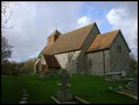
At the top of the hill lies the church, and about 1/2 mile away towards
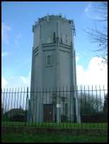
Jevington is the old Water Tower, which although stark can be seen for
miles around and is most unusual.
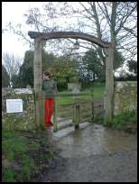
The churchyard contains an unusual Tapsell Gate , produced by a carpenter from
Mountfield in the mid 1700's. It rotates on a post, in a similar way to the
design of a Post Mill . |
|
 Friston in East Sussex lies on top of the downs, and from the Jevington road can be seen
across the Seven Sisters country park the port of Newhaven with its ships. Friston in East Sussex lies on top of the downs, and from the Jevington road can be seen
across the Seven Sisters country park the port of Newhaven with its ships.
All around lies the rolling Downs and their beautiful scenery. |
|
 Friston in East Sussex is a small village with few services , the nearest shops are at
East Dean about 1/2 mile to the east.
The nearest major shops are at Eastbourne which lies to the east about 6 miles,
main line trains along the coast can be caught from there. Friston in East Sussex is a small village with few services , the nearest shops are at
East Dean about 1/2 mile to the east.
The nearest major shops are at Eastbourne which lies to the east about 6 miles,
main line trains along the coast can be caught from there. |
|
| Friston is shown as the red symbol on the map. |
|
|
Nearby Villages
(click on symbol to see the village page) |
| Village= | |
Town= | |
Recorded in Domesday= |  |
| |
|
|
Alfriston |
(Smuggling and Ghosts) | | 3.68 miles |
|
|
Bishopstone |
(Largest Tide-Mill in Sussex) | | 5.38 miles |
|
|
Denton |
(Earl Godwins Manor) | | 6.82 miles |
|
|
East Blatchington |
(Mutiny and the Edge of Space) | | 4.69 miles |
|
|
East Dean |
(Fishing and Wrecking) | | 0.48 miles |
|
|
Exceat |
(Alfred the Great's Naval Base?) | | 2.42 miles |
|
|
Folkington |
(Teasles and Badgers) | | 3.46 miles |
|
|
Jevington |
(Smugglers and Churchill Tanks) | | 1.96 miles |
|
|
Litlington |
(Secret marriage of George IV) | | 2.78 miles |
|
|
Lullington |
(destroyed by Cromwell ??) | | 3.26 miles |
|
|
Pevensey |
(Ancient Roman Fortification) | | 7.14 miles |
|
|
Pevensey Bay |
(Fishing and Martello Towers) | | 7.13 miles |
|
|
Seaford |
(The cormorants or shags) | | 4.57 miles |
|
|
Westham |
(Enclosure for the Castle) | | 6.36 miles |
|
|
Wilmington |
(The Long Man) | | 3.77 miles |
|
|
| Copyright Villagenet 1998-2024 | |
| |
|
|
Local Interest
Just click an image |
|
|
|
|
|
|
|
|
|
|
|
|
|
|
| |