| |

|
|
|
| |
 Glynde in East Sussex lies to the north of the A27 on the back road to Ringmer . Its name
is derived from the old Saxon word glind meaning an enclosure. The road
through the village used to be on the main coaching route from Lewes to
Eastbourne and Newhaven. It has the feel of Northern England with its rows
of terraced cottages, and seems out of place in the South Downs . Glynde in East Sussex lies to the north of the A27 on the back road to Ringmer . Its name
is derived from the old Saxon word glind meaning an enclosure. The road
through the village used to be on the main coaching route from Lewes to
Eastbourne and Newhaven. It has the feel of Northern England with its rows
of terraced cottages, and seems out of place in the South Downs .
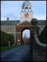
In the 1200's Glynde Place was built and in 1579 the current building was
created with dragons on either side of the entrance.
Glynde is the birthplace of the delicate bright pink faced Southdown
sheep which were bred in the 1700's by John Ellman who is buried in the
churchyard. This breed of sheep can be found as far afield as Australia
and South Africa.(See
Southdown Sheep Society)
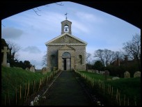
The current unusual church was built in 1763-5 in the Italian style by
Richard Trevor the Bishop of Durham who was the owner of Glynde place.
The church was designed by Sir Thomas Robinson Bart an architect and
landowner from Yorkshire . The building lies on top of the old Norman
church of which only a few artifacts remain.
In the churchyard is another example of a Harmer Terracotta created by
Jonathan Harmer in the early 1800's.
On 28th May 1934 John Christie whose family had lived at Glyndebourne an
old Tudor manor since 1617, opened the Glyndebourne Opera House. The
building catered for about 300 people, and became synonymous with English
Opera. In 1992 the building was demolished and a new one contructed, this
was opened in 1994 seating 1150 people. Glyndebourne is now the major
operatic centre in the UK.
Glynde Reach lies to the south east of Glynde, and as the derivation of
'reach' means 'An inlet of the sea' it is assumed that the Sea Level in the past
would have been up to 10 ft higher than at present. The Ordnance Survey map
from 1813 shows the sea coming all the way to the Laughton Levels , possibly
this was shown as high tide levels.. |
|
 Glynde in East Sussex lies just to the west of Mount Caburn at 480 ft high one of the higher
landmarks in Sussex, this is one of those areas settled in prehistoric times
as tumuli are all around. Glynde in East Sussex lies just to the west of Mount Caburn at 480 ft high one of the higher
landmarks in Sussex, this is one of those areas settled in prehistoric times
as tumuli are all around.
The whole area is one of the South Downs with its steep green hills and
wide vistas and very low lying river valleys.
The church is very unusual and seems out of place in this downland village
with its Italian styling, however it is worth visiting, and over the wall
from the churchyard can be seen the dragon statues guarding Glynde Place. |
|
 Glynde in East Sussex lies just off the main A27 and has a few small village services ,
but the nearest shopping centre is at Lewes about 2 miles north west via
Ringmer . Glynde in East Sussex lies just off the main A27 and has a few small village services ,
but the nearest shopping centre is at Lewes about 2 miles north west via
Ringmer .
The village benefits from a station on the Eastbourne to Lewes and Brighton
line giving regular coastal services. |
|
| Glynde is shown as the red symbol on the map. |
|
|
Nearby Villages
(click on symbol to see the village page) |
| Village= | |
Town= | |
Recorded in Domesday= |  |
| |
|
|
Alciston |
(Fifty thousand tiles on the Barn) | | 3.69 miles |
|
|
Alfriston |
(Smuggling and Ghosts) | | 5.39 miles |
|
|
Arlington |
(Peaceful Saxon Village) | | 5.54 miles |
|
|
Barcombe |
(Village in three places) | | 4.22 miles |
|
|
Beddingham |
(At the base of Mount Caburn) | | 0.94 miles |
|
|
Berwick |
(Sharpen your arrows on the Church) | | 4.51 miles |
|
|
Chalvington |
(The miniature church) | | 4.01 miles |
|
|
Chiddingly |
(Walking on Cheese ??) | | 6.36 miles |
|
|
Folkington |
(Teasles and Badgers) | | 7.01 miles |
|
|
Laughton |
(Knight captures King of France) | | 3.84 miles |
|
|
Ringmer |
(Poor Roads and riots) | | 2.20 miles |
|
|
Ripe |
(Earl Harolds estate) | | 3.34 miles |
|
|
Selmeston |
(Tomb to store the Contraband) | | 3.56 miles |
|
|
Tarring Neville |
(The Chest from the Spanish Armarda) | | 3.31 miles |
|
|
Wilmington |
(The Long Man) | | 6.20 miles |
|
|
Firle |
(Home of the Greengage) | | 1.41 miles |
|
|
| Copyright Villagenet 1998-2025 | |
| |
|
|
Local Interest
Just click an image |
|
|
|
|
|
|
|
|
|
|
|
|
|
|
| |