| |

|
|
|
| |
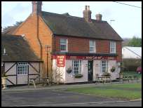
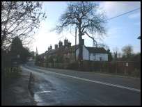
 Halland in East Sussex is a small straggling village on the A22 London to Eastbourne
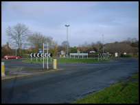
main road. The village is located on a cross road, what is now a
roundabout, where the Heathfield to Lewes road crosses the A22 . Halland in East Sussex is a small straggling village on the A22 London to Eastbourne
main road. The village is located on a cross road, what is now a
roundabout, where the Heathfield to Lewes road crosses the A22 .
Until the late 1890s Halland was known as The Nursery .
There are two legend about Terrible Down and why it came to be named
that way. The first is that Alfred the Great fought the vikings here
and that the slaughter was so terrible that the streams ran red with
blood. The second is that Henry III'd army that was defeated at the
Battle of Lewes by Simon de Montfort turned to face their pursuers
at Terrible Down, and were cut down to a man.
Halland has been dominated by the Pelham family from about 1595
to 1768. In 1356 at the Battle of Poitiers a knight from Laughton
Sir John Pelham together with Sir Roger De La Warr captured Jean the King
of France, because of this the Sir John was given the Kings belt buckle as a
badge of honour. This badge can be seen in many churches in the area showing
the influence and power of the Pelham family. ( see Laughton and East Hoathly )
In 1595 the Pelham family built a new house in Halland because the 'air
was nicer' presumably less damp than in Laughton as it lies lower in the
valley.
The area was tied to the iron industry as it is close to the Waldron and
Heathfield furnaces and the charcoal works at Blackboys the results are
visible as there are iron milestones in the area with the Pelham Buckle
on them. The village was probably used as a resting point for the teams
of oxen pulling the completed cannons to Lewes .
The Pelhams left Halland in 1768 to move to Stanmer, possibly due to
the air polution from the nearby furnaces, Halland Place was demolished
and used for building materials. |
|
 Looking south west from Halland in East Sussex you can see the South Downs which
are very imposing , even from this distance. Looking south west from Halland in East Sussex you can see the South Downs which
are very imposing , even from this distance.
The whole area is made up of rolling hills and farming land which
is very attractive especially when the trees have come back into leaf.
The gliders from nearby Ringmer Gliding Club can be seen circling
on warm summer weekends. |
|
 Halland in East Sussex has a few local village services, with one or two larger
concerns, which rely on the A22 for business. Halland in East Sussex has a few local village services, with one or two larger
concerns, which rely on the A22 for business.
The nearest shopping centre is at Uckfield about 6 miles to the north
up the A22, together with the nearest train service to London.
Larger shops can be found at Lewes , the county town about 10 miles
south west. |
|
| Halland is shown as the red symbol on the map. |
|
|
Nearby Villages
(click on symbol to see the village page) |
| Village= | |
Town= | |
Recorded in Domesday= |  |
| |
|
|
Barcombe |
(Village in three places) | | 5.24 miles |
|
|
Blackboys |
(Charcoal and Soot) | | 2.22 miles |
|
|
Broad Oak |
(Smallpox at the Academy) | | 7.41 miles |
|
|
Cade Street |
(Jack Cade and the Kentish rebellion) | | 6.97 miles |
|
|
Chiddingly |
(Walking on Cheese ??) | | 3.02 miles |
|
|
Cross in Hand |
(The Crusaders Assembly) | | 4.91 miles |
|
|
East Hoathly |
(Another Sussex Cannibal?) | | 1.33 miles |
|
|
Framfield |
(380 years without a church tower) | | 2.46 miles |
|
|
Heathfield |
(19th Century Natural Gas) | | 5.88 miles |
|
|
Hellingly |
(Only remaining Ciric in Sussex) | | 5.62 miles |
|
|
Horam |
(Which Station do we get off at ?) | | 4.71 miles |
|
|
Isfield |
(Simon de Montfort and the Lavender Line) | | 3.12 miles |
|
|
Laughton |
(Knight captures King of France) | | 2.16 miles |
|
|
Newick |
(Killer Cricket and Dirk Bogarde) | | 6.19 miles |
|
|
Piltdown |
(The Piltdown Man hoax) | | 4.86 miles |
|
|
Ringmer |
(Poor Roads and riots) | | 4.38 miles |
|
|
Uckfield |
(Traction Engine destroys bridge) | | 3.11 miles |
|
|
Vines Cross |
(Cannons and Doodlebugs) | | 5.75 miles |
|
|
Waldron |
(Fullers Earth) | | 3.40 miles |
|
|
Warbleton |
(The Iron Man) | | 6.72 miles |
|
|
| Copyright Villagenet 1998-2025 | |
| |
|
|
Local Interest
Just click an image |
|
|
|
|
|
|
|
|
|
|
|
|
|
|
| |