| |

|
|
|
| |
 Heathfield in East Sussex lies on the A265, midway along an ancient
track called the Ridgeway, that since pre-historic
times, has been the link between the South Downs and
the Weald. Heathfield in East Sussex lies on the A265, midway along an ancient
track called the Ridgeway, that since pre-historic
times, has been the link between the South Downs and
the Weald.
Legend has it that a quaintly dressed old lady always
turns up at the annual April Heffle Cuckoo Fair , to
release from her basket the first cuckoo of spring.
Formerly the fair was held behind the Half Moon Inn now
known as the ' Jack Cade ' in Cade Street . It now takes
place in and around the Community Hall and Health Centre,
in Sheep Setting Lane.
Between the 1600 and the 1800's the Fuller family from
Brightling , ran an iron furnace at Heathfield which
produced cannons for the Royal Navy. The Iron Ore was
mined locally, and the charcoal used to fire the ore
was also produced locally, some from Blackboys (Another local
village, named after the colour of the charcoal burners).
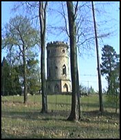
East of the town is the walled Heathfield Park, where
may be seen a round, castellated folly, called the
Gibraltar Tower. This tower was built in 1792 by Francis
Newbury, in honour of General Sir George Augustus Elliot,
a Govenor of Gibraltar, who successfully defended 'the
Rock' against the combined French and Spanish forces
between 1779 and 1783.
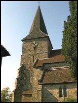
At the south eastern corner of the park lies Old
Heathfield , which consists of a church, a pub, and a few
cottages. In the churchyard lies a fine example of a
Harmer terracotta decorated gravestone, this is best
viewed from the road, as it lies behind trees, and faces
west.
Heathfield used to be called Tower Street, and it grew
up around the railway station on the old Polegate to
Tunbridge Wells line(now closed). This busy single
track line built in 1880 was known as the Cuckoo Line .
It was axed in 1965 by Dr Beeching, when the local authorities took
this opportunity to use part of it to create a linear
Country Park and Nature Reserve. An appreciation of
the ' Cuckoo Trail ' grows from year to year, and it is
hoped it may eventually be extended.
Among the trees, near the bridge in Ghyll Road,
north-west from sandy cross on the B2203 is an old stand
pipe. This is the last remnant of Heathfield's natural
gas industry. In its heyday it produced some 15 million
cubic feet a day, and provided the railway station with
lighting until the 1930's. The gas was discovered in 1895
when engineers were actually looking for water. However
the operation never proved commercially viable. A
medallion was struck to commemorate the coronation
of Edward VII and Queen Alexandra - one side portrayed
the Royal heads, and the other side was the inscription
'Heathfield, Sussex, 1902. Natural gas first used for
light and power'.
(Our thanks go to Alf Rogers for the next details) In the quarter century that I lived in the area, the Heffle Cuckoo
Fair was held at the Heathfield Market site which was adjacent to
the Crown Hotel at the junction of the roads to Burwash and Battle .
It was never to my knowledge located by the Half Moon Inn (I note
that this has a name change). Originally held strictly on the
15th April, it was by the 1950's held on the Saturday nearest to
the 15th. The legend of the old lady bringing the first cuckoo
of spring to release from a wicker cage was enacted as a regular
feature. In the years I lived in the area I only heard the cuckoo
once before that date so legend was pretty firmly founded upon
its normal migration pattern. |
|
 Old Heathfield in East Sussex which can be driven to by travelling
down the Battle road, and turning right just before
you get to Cade Street , is very picturesque. Old Heathfield in East Sussex which can be driven to by travelling
down the Battle road, and turning right just before
you get to Cade Street , is very picturesque.
The road that goes down towards the old station has
the feel of the early 20th century.
The main village centre is a nice example of late
19th Century rural Sussex. |
|
 Heathfield in East Sussex is a major centre for the surrounding area
with a good range of shops, and is also the centre
of the bus routes from the villages. Heathfield in East Sussex is a major centre for the surrounding area
with a good range of shops, and is also the centre
of the bus routes from the villages.
The nearest trains are in Wadhurst or Tunbridge Wells
giving a service running every 30 minutes, taking
about 1 hour to London.
The nearest major shopping centres are at Tunbridge
Wells about 12 miles north, or Eastbourne about 12
miles south. |
|
| Heathfield is shown as the red symbol on the map. |
|
|
Nearby Villages
(click on symbol to see the village page) |
| Village= | |
Town= | |
Recorded in Domesday= |  |
| |
|
|
Ashburnham |
(Last Iron Furnace in Sussex) | | 7.17 miles |
|
|
Blackboys |
(Charcoal and Soot) | | 4.69 miles |
|
|
Bodle Street |
(White Horse on the roof) | | 5.26 miles |
|
|
Brightling |
(famous for Mad Jack Fuller) | | 6.25 miles |
|
|
Broad Oak |
(Smallpox at the Academy) | | 1.53 miles |
|
|
Burwash |
(The home of Rudyard Kipling) | | 6.19 miles |
|
|
Burwash Common |
(Roughest pub in the South East) | | 3.91 miles |
|
|
Burwash Weald |
(Roughest pub in the South East) | | 4.34 miles |
|
|
Buxted |
(The first Iron Cannon in England) | | 5.66 miles |
|
|
Cade Street |
(Jack Cade and the Kentish rebellion) | | 1.20 miles |
|
|
Cross in Hand |
(The Crusaders Assembly) | | 1.51 miles |
|
|
Dallington |
(Custers Last Stand!) | | 4.64 miles |
|
|
East Hoathly |
(Another Sussex Cannibal?) | | 4.89 miles |
|
|
Five Ashes |
(Vast collection of rock plants) | | 2.99 miles |
|
|
Framfield |
(380 years without a church tower) | | 5.61 miles |
|
|
Hadlow Down |
(Wealden Cannons and Charcoal) | | 3.75 miles |
|
|
Halland |
(Ancient Slaughter) | | 5.88 miles |
|
|
Horam |
(Which Station do we get off at ?) | | 2.38 miles |
|
|
Mayfield |
(Saint Dunstan and the Devil) | | 3.76 miles |
|
|
Penhurst |
(Beautiful yet Remote) | | 7.36 miles |
|
|
Punnetts Town |
(The Windmill on the Hill) | | 2.82 miles |
|
|
Rushlake Green |
(Open Village and Nuclear Bunker) | | 3.08 miles |
|
|
Vines Cross |
(Cannons and Doodlebugs) | | 2.08 miles |
|
|
Waldron |
(Fullers Earth) | | 2.49 miles |
|
|
Warbleton |
(The Iron Man) | | 2.27 miles |
|
|
| Copyright Villagenet 1998-2025 | |
| |
|
|
Local Interest
Just click an image |
|
|
|
|
|
|
|
|
|
|
|
|
|
|
| |