| |

|
|
|
| |
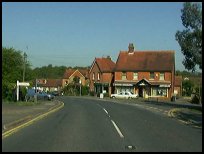
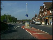
 Horam in East Sussex was a small hamlet about 3 miles south of Heathfield on the A 267, until
the opening of the Cuckoo Line railway . The hamlet grew due to the Express
Dairies depot and until recent times it was known as Horeham. Horam in East Sussex was a small hamlet about 3 miles south of Heathfield on the A 267, until
the opening of the Cuckoo Line railway . The hamlet grew due to the Express
Dairies depot and until recent times it was known as Horeham.
The MP for Sussex from 1685-1687 Sir Thomas Dyke lived in the Manor house, which
was part of the Manor of Warbleton. After his short term in office for Sussex he
was in 1689-1698 elected as MP for East Grinstead. In 1728 the Dyke family moved
to Lullingstone Castle in Kent .
Records show the price of land in this area in 1731, Mrs Hobarts bought 28 acres
of land adjacent to the land of the Iron Master family of the Fuller's for £220.
In 1880 the Cuckoo Line was built from Eridge to Polegate , and Horam Station was
built. The passengers must have wondered at which station they would get off at
as Horam station was called Horeham Road, then Waldron, Horeham Road - Waldron,
Waldron - Horeham Road, then in 1953 Horam. Horeham was the main depot for Express
Dairies, and the main goods traffic on the line came from the Depot.
During the second world war, Horam had the dubious honour of being the first
village in the area to be hit by bombs and doodlebugs . Streeton Nursery at
Vine Cross was hit by a bomb on 17th July 1944, and Riverdale Nursery was hit
by a doodlebug 16th June 1944.
In 1946 the Merrydown wine and cider making company was formed and operated from
a cottage of the same name. It has now grown into a major international Company,
which was based in Horam. The two founders of the company were actually
from Kent and that was where they started making their products in England
(they originally made their cider in a prison camp in Germany).
It is a fact that their Merrydown cider was a hit in their home county
and they looked for new premises. Horam Manor (already mentioned in this
text) had been gutted by fire shortly after the war's end but the shell
of the building was structurally sound. There Merrydown installed their
new vats and expanded their trade. At the same time they increased the
range of their products, introducing many country wines such as
Elderberry and Gooseberry and producing a very fine Mead. (Many thanks again to Alf Rogers for the above.)
The Cuckoo Line has now been turned into the Cuckoo Trail , a country amenity
owned by the East Sussex Council , it is open for cycling and walking from
Heathfield through Horam , Hellingly and Hailsham to Polegate . |
|
 The Cuckoo Trail is very pretty and is well worth walking or cycling along. The Cuckoo Trail is very pretty and is well worth walking or cycling along.
To the south are the South Downs at Eastbourne, and just up the road at Heathfield
is the Gibraltar Tower, an old folly. |
|
 The village has quite a number of shops and public houses. The village has quite a number of shops and public houses.
The nearest supermarket and market town is at Heathfield 3 miles north, with a major
shopping centre at Eastbourne 12 miles south.
The nearest trains are in Wadhurst or Tunbridge Wells giving a service running every
30 minutes, taking about 1 hour to London. |
|
| Horam is shown as the red symbol on the map. |
|
|
Nearby Villages
(click on symbol to see the village page) |
| Village= | |
Town= | |
Recorded in Domesday= |  |
| |
|
|
Ashburnham |
(Last Iron Furnace in Sussex) | | 6.74 miles |
|
|
Blackboys |
(Charcoal and Soot) | | 4.49 miles |
|
|
Bodle Street |
(White Horse on the roof) | | 4.56 miles |
|
|
Boreham Street |
(Picturesque village on top of the Ridge) | | 6.70 miles |
|
|
Broad Oak |
(Smallpox at the Academy) | | 3.61 miles |
|
|
Burwash Common |
(Roughest pub in the South East) | | 5.54 miles |
|
|
Burwash Weald |
(Roughest pub in the South East) | | 5.92 miles |
|
|
Buxted |
(The first Iron Cannon in England) | | 6.21 miles |
|
|
Cade Street |
(Jack Cade and the Kentish rebellion) | | 2.91 miles |
|
|
Chiddingly |
(Walking on Cheese ??) | | 2.80 miles |
|
|
Cross in Hand |
(The Crusaders Assembly) | | 2.89 miles |
|
|
Dallington |
(Custers Last Stand!) | | 5.09 miles |
|
|
East Hoathly |
(Another Sussex Cannibal?) | | 3.44 miles |
|
|
Framfield |
(380 years without a church tower) | | 5.47 miles |
|
|
Halland |
(Ancient Slaughter) | | 4.71 miles |
|
|
Heathfield |
(19th Century Natural Gas) | | 2.38 miles |
|
|
Hellingly |
(Only remaining Ciric in Sussex) | | 3.12 miles |
|
|
Herstmonceux |
(Castle and Observatory) | | 4.64 miles |
|
|
Laughton |
(Knight captures King of France) | | 5.35 miles |
|
|
Punnetts Town |
(The Windmill on the Hill) | | 3.84 miles |
|
|
Rushlake Green |
(Open Village and Nuclear Bunker) | | 3.21 miles |
|
|
Uckfield |
(Traction Engine destroys bridge) | | 6.84 miles |
|
|
Vines Cross |
(Cannons and Doodlebugs) | | 1.06 miles |
|
|
Waldron |
(Fullers Earth) | | 2.14 miles |
|
|
Warbleton |
(The Iron Man) | | 2.03 miles |
|
|
Windmill Hill |
(Largest Post Mill in Sussex) | | 5.46 miles |
|
|
| Copyright Villagenet 1998-2025 | |
| |
|
|
Local Interest
Just click an image |
|
|
|
|
|
|
|
|
|
|
|
|
|
|
| |