| |

|
|
|
| |
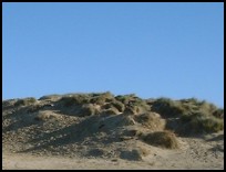
 Old Winchelsea in East Sussex was located about 1 mile to the south east of Winchelsea
on an island between modern day Rye Harbour and Winchelsea Beach . Old Winchelsea in East Sussex was located about 1 mile to the south east of Winchelsea
on an island between modern day Rye Harbour and Winchelsea Beach .
Old Winchelsea was an old Saxon fishing port with trading links between europe and England.
Before the Norman conquest Old Winchelsea was an important enough port
to have its own mint. In Edward the Confessors time a confederation of
local ports, later to be known as the Cinque Ports, were granted
semi-independant status in return for providing ships and sailors to
the crown, Winchelsea was a major contributor.
In 1067 William the Conqueror returned to Normandy, and on his return
landed at Old Winchelsea now a major port.
A report from the time of Henry III in the 1260's describes Old Winchelsea
as 'a pretty town' and shows the size of the old town, there were over 700
houses, 2 churches and over 50 inns and taverns implying a population of
4-5 thousand people. During the Hundred Years War, Old Winchelsea provided
21 ships and 596 men for the king . The churches of St Thomas and St Giles
and a Franciscan monastic house provided spiritual support for the population.
The 1200's provided a catastrophic time for Old Winchelsea, it was attacked
by the French a number of times and swamped by the sea. The sea washed away
part of the town in 1250, 1252 and again in 1254. During this time 300 houses
and churches were swept away.
Sixteen years later in 1266 it was sacked by Prince Edward, in order to put
an end to the indiscriminate piracy rife amongst Old Winchelsea's seamen.
In 1282 the King's treasurer had been sent to the Old town to investigate
the danger to the town from the sea, the report was to abandon the town and
create a new town on the heights of Petit Ihamme nowadays Icklesham .
Then before the plans could be carried out in 1287 a Great Storm destroyed
the remains of the old settlement, the survivors moved to the area of the
new town. The new Winchelsea was built by Edward I, designed on the grid system,
with it's tidal harbour on the river Brede . |
|
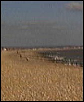
 The views from the island in the sea must have been similar to those
that can be found at Winchelsea Beach and Camber sands, when looking out
to sea you can imagine hundreds of sailing ships tied up to the island. The views from the island in the sea must have been similar to those
that can be found at Winchelsea Beach and Camber sands, when looking out
to sea you can imagine hundreds of sailing ships tied up to the island.
Inland where Winchelsea now lies would have been forested headland. |
|
 By all accounts Old Winchelsea in East Sussex would have been an extremely good place
to have lived, as it had all the services of a busy port, and thriving town. By all accounts Old Winchelsea in East Sussex would have been an extremely good place
to have lived, as it had all the services of a busy port, and thriving town.
Nothing remains of Old Winchelsea as with Broomhill so we will have to
imagine its bustling and busy streets. |
|
| Old Winchelsea is shown as the red symbol on the map. |
|
|
Nearby Villages
(click on symbol to see the village page) |
| Village= | |
Town= | |
Recorded in Domesday= |  |
| |
|
|
Brede |
(Edward I inspects the Channel Fleet) | | 5.69 miles |
|
|
Broad Oak Brede |
(On the Crossroads) | | 5.87 miles |
|
|
Broomhill |
(Swept away by the Storm) | | 3.92 miles |
|
|
Camber |
(Sands and Holidays) | | 3.17 miles |
|
|
East Guldeford |
(Barn-like Church) | | 2.75 miles |
|
|
Fairlight |
(Firehills and Views) | | 4.38 miles |
|
|
Guestling |
(Changing guards at Buckingham Palace) | | 4.42 miles |
|
|
Hastings East Cliff |
(Beautiful Views and peaceful Walks) | | 6.24 miles |
|
|
Hastings Ore |
(Iron and the Turnpike) | | 6.38 miles |
|
|
Icklesham |
(Paul McCartney's Recording Studio) | | 2.41 miles |
|
|
Peasmarsh |
(Black Death moves village) | | 4.29 miles |
|
|
Pett |
(End of the Royal Military Canal) | | 3.38 miles |
|
|
Playden |
(Saltcote and fish) | | 3.56 miles |
|
|
Rye |
(On the Island) | | 1.84 miles |
|
|
Rye Harbour |
(Nature Reserve and unspoilt beaches) | | 1.88 miles |
|
|
Udimore |
(Angels move the Church) | | 3.56 miles |
|
|
Westfield |
(Bonfire Boys under suspicion) | | 6.79 miles |
|
|
Winchelsea |
(Inland Cinque Port !!) | | 0.71 miles |
|
|
Winchelsea Beach |
(Holidaymakers and Henry VIIIs Fort) | | 0.54 miles |
|
|
| Copyright Villagenet 1998-2025 | |
| |
|
|
Local Interest
Just click an image |
|
|
|
|
|
|
|
|
|
|
|
|
|
|
| |