| |

|
|
|
| |
 Pett in East Sussex lies 4 miles east of Hastings on the Fairlight
to Rye road. Its first mention is in the Domesday Book
and was known then as Luet. Pett in East Sussex lies 4 miles east of Hastings on the Fairlight
to Rye road. Its first mention is in the Domesday Book
and was known then as Luet.
It consists of a collection of houses and bungalows that
straggle along about 1 1/2 miles of road, which swings
steeply down at its East end to Pett Level, a wide
expanse of land which is a haven for wildfowl.
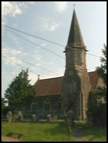
The church of St Mary and St Peter, was built in the 1860's
for £2000. Its most noteworthy features are its tall,
octagonal belfry and spire, and the large gargoyles that
peer down from it. On the north side of the nave is a
modern stained glass window depicting St Nicholas with
a lifeboat man, this was designed by Lawrence Lee.
In 1690 a British frigate, the 'Anne', after a Battle
off Beachy Head between the French, British and Dutch
fleets was beached on the coast and burnt by her captain.
The Royal Military Canal, runs from Shorecliffe in Kent
to Cliff End at Pett Level . It was built to keep
out Napoleons Army, but was barely finished before
it was realised what a pointless operation it was. Any
army that had crossed Europe's great rivers, and then
the English Channel were hardly going to be defeated
by a canal barely 30 ft wide!
On the beach at low tide can be seen the remains of an
ancient forest, which was drowned when the Sea Level rose
after the last Ice Age and the trees were preserved in the
saltwater and mud. However since then the Sea Level has
dropped slightly, and the tides and waves have washed away
some of the silt and mud to reveal the old forest. |
|
 Pett in East Sussex village is very quiet and pretty. Pett in East Sussex village is very quiet and pretty.
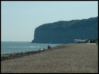
The beach at Pett Level has beautiful views, from the top
of the sea defences. The cliffs at Fairlight , can be seen
to the west, and are at their best on a summer morning or
early afternoon. To the east on a clear day you can make
out the blocky shape of Dungeness nuclear power station.
Also to the east lies Camber , with its sandy beaches that
make it famous. |
|
 An infrequent Hastings to Rye bus route passes through the village. An infrequent Hastings to Rye bus route passes through the village.
The nearest main station is in Hastings , with an hourly journey to London,
Eastbourne and Ashford . The nearest local station is at Winchelsea
on the Ashford line. The main shopping centre is Hastings about 4 miles West. |
|
| Pett is shown as the red symbol on the map. |
|
|
|
|
| Copyright Villagenet 1998-2025 | |
| |
|
|
Local Interest
Just click an image |
|
|
|
|
|
|
|
|
|
|
|
|
|
|
| |