| |

|
|
|
| |
 Polegate in East Sussex lies on the Roman road which ran from Pevensey Castle (Anderida) to Lewes. Polegate in East Sussex lies on the Roman road which ran from Pevensey Castle (Anderida) to Lewes.
To the north of the village lay Otham Priory which was built in 1175, and was closed
in the 1200's when the monks moved to settle Bayham Abbey between Lamberhurst and
Bells Yew Green. The remains of the abbey can be seen from the Cuckoo Trail. Otham
was founded by Ralph de Dene (from West Dean near Seaford ), of the Premonstratensian
Order who was a sub tenant of Pevensey Castle . The monks moved to Bayham Abbey
because 'Otham was impossibly damp and inhospitable', as it lay in the Pevensey Marshes.
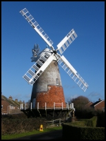
In 1817 the Polegate Windmill was built, replacing an old post mill on the
South Downs. The mill is a tower type, which is now open to the public
in the summer thanks to volunteers. The windmill can now be found in
the middle of a housing estate, which has built up in the 20th century.
The Cuckoo Line (Steam Railway) track was started in 1849 with the single track
link from Polegate to Hailsham . In September 1880 a further length of single
track line from Eridge to Hailsham was opened, providing a service from Charing
Cross to Eastbourne via Tunbridge Wells . Polegate became one of the main centres
of rail travel, with its sidings for the Cuckoo Line , and its station on the
main Hastings Eastbourne Lewes line.
The village is now a starting point for the Cuckoo Trail , a walk owned by the
County Council, which meanders through the East Sussex countryside to Heathfield.
Polegate village is a fairly modern settlement built around the railway lines,
the town of Eastbourne has grown significantly since the 1850's and now has
absorbed Polegate a suburb . |
|
 Polegate in East Sussex has the starting point for the picturesque walk of the Cuckoo Trail which
can be cycled or walked to Heathfield , via Hailsham , Hellingly and Horam .
To the south are the magnificent vistas of the South Downs. Polegate in East Sussex has the starting point for the picturesque walk of the Cuckoo Trail which
can be cycled or walked to Heathfield , via Hailsham , Hellingly and Horam .
To the south are the magnificent vistas of the South Downs. |
|
 Polegate in East Sussex has many local services, the main shopping centres are in Hailsham to the
north about 4 miles, or Eastbourne to the south, about the same distance. Polegate in East Sussex has many local services, the main shopping centres are in Hailsham to the
north about 4 miles, or Eastbourne to the south, about the same distance.
The main line service from Hastings to Lewes runs through the village, and stops
at the station. |
|
| Polegate is shown as the red symbol on the map. |
|
|
Nearby Villages
(click on symbol to see the village page) |
| Village= | |
Town= | |
Recorded in Domesday= |  |
| |
|
|
Alciston |
(Fifty thousand tiles on the Barn) | | 4.77 miles |
|
|
Alfriston |
(Smuggling and Ghosts) | | 3.99 miles |
|
|
Arlington |
(Peaceful Saxon Village) | | 2.74 miles |
|
|
Berwick |
(Sharpen your arrows on the Church) | | 4.04 miles |
|
|
Boreham Street |
(Picturesque village on top of the Ridge) | | 6.55 miles |
|
|
Chalvington |
(The miniature church) | | 4.66 miles |
|
|
East Blatchington |
(Mutiny and the Edge of Space) | | 7.05 miles |
|
|
Exceat |
(Alfred the Great's Naval Base?) | | 5.25 miles |
|
|
Folkington |
(Teasles and Badgers) | | 1.67 miles |
|
|
Hailsham |
(Ropes and Napoleon) | | 2.87 miles |
|
|
Jevington |
(Smugglers and Churchill Tanks) | | 2.58 miles |
|
|
Litlington |
(Secret marriage of George IV) | | 4.45 miles |
|
|
Lullington |
(destroyed by Cromwell ??) | | 3.86 miles |
|
|
Normans Bay |
(Last Invasion in 1066) | | 6.61 miles |
|
|
Pevensey |
(Ancient Roman Fortification) | | 4.22 miles |
|
|
Pevensey Bay |
(Fishing and Martello Towers) | | 4.38 miles |
|
|
Ripe |
(Earl Harolds estate) | | 5.47 miles |
|
|
Seaford |
(The cormorants or shags) | | 7.19 miles |
|
|
Selmeston |
(Tomb to store the Contraband) | | 4.58 miles |
|
|
Wartling |
(World War II defence centre) | | 5.47 miles |
|
|
Westham |
(Enclosure for the Castle) | | 3.56 miles |
|
|
Wilmington |
(The Long Man) | | 2.33 miles |
|
|
| Copyright Villagenet 1998-2025 | |
| |
|
|
Local Interest
Just click an image |
|
|
|
|
|
|
|
|
|
|
|
|
|
|
| |