| |

|
|
|
| |
 Reading Street And Ebony in Kent lie on the B2080 Appledore to Tenterden road. Reading Street And Ebony in Kent lie on the B2080 Appledore to Tenterden road.
Reading Street is the village on the spit of land to the north of Ebony .
Ebony was the old name for the bank of land now called Chapel Bank between
Reading Street and the Isle of Oxney . During Saxon times it was an island
with the Rother and sea surrounding it, known as Ebon Ie (Ebon's Island)
and had a church and a priory on it. The road to the Isle of Oxney would
have come down the hill from Tenterden , a ferry would have gone over to
Ebony then another would have gone from the island to the Isle of Oxney .
The church was hit by lightning during Elizabeth I's reign and destroyed.
Subsequently a chapel was built hence the current name, although this has
now gone.
Believe it or not, Reading Street and Ebony used to provide workers for the
flourishing port and a centre for ship-building at Smallhythe !
Timber from the Wealden Forests was collected in Tenterden , then
sent to Smallhythe for the building of ships. The River Rother
used to flow past Reading Street to the sea and was of sufficient
width and depth to accommodate the main warships of the period.
The shipyards became famous from the 14th to the middle 16th century.
One of Henry VIII's warships 'The Grand Masters' was built in the
Smallhythe , and in 1537 Henry VIII visited the construction site to
view the building of this great vessel. It would have been a magnificent
sight being towed down the river past Reading Street and Ebony to the sea
at Rye .
Nowadays Ebony only has sheep on it, the Rother flows south of the
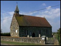
Isle of Oxney and is very small and Reading Street has a small church
a public house and a garden centre, so the area has seen major changes. |
|
 Reading Street lies on a promentory overlooking the Romney Marsh
all around lies the flat lands of the Rother Levels , and the area
is quiet and peaceful. Reading Street lies on a promentory overlooking the Romney Marsh
all around lies the flat lands of the Rother Levels , and the area
is quiet and peaceful.
If you head towards the Isle of Oxney the area gets quieter and
more peaceful. Imagine if you can the construction of huge sailing
warships in Henry VIII's time, on the Rother where now is farmland. |
|
 Reading Street is a very small village with a church, a garden centre
and a public house to provide services. Reading Street is a very small village with a church, a garden centre
and a public house to provide services.
Tenterden provides the main shopping area about 4 miles to the north.
Trains can be caught at Appledore station about 6 miles south, these
are on the Hastings to Ashford service across the Romney Marsh . |
|
| Reading Street And Ebony is shown as the red symbol on the map. |
|
|
Nearby Villages
(click on symbol to see the village page) |
| Village= | |
Town= | |
Recorded in Domesday= |  |
| |
|
|
| Copyright Villagenet 1998-2024 | |
| |
|
|
Local Interest
Just click an image |
|
|
|
|
|
|
|
|
|
|
|
|
|
|
| |