| |

|
|
|
| |
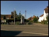
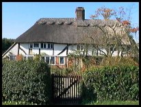
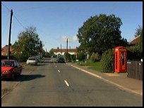
 Staplecross in East Sussex lies 9 miles north of Hastings on the B2165. Staplecross in East Sussex lies 9 miles north of Hastings on the B2165.
Although it is little more than a hamlet on a T-junction,
consisting of a handful of houses and a pub, it holds
historical importance.
During the middle ages and later it was the central
point of the Hundred of Staple, consisting of the
villages of Northiam , Ewhurst Green , Bodiam , and
Sedlescombe , along with parts of Brede , Mountfield
and Whatlington .
The Hundred was a Saxon territorial subdivision,
named possibly because it contained 100 families,
or provided 100 men-at-arms for the area.
In 1833 William Goodsell, a resident of Staplecross,
was accused of starting a fire in a farm building at
nearby Ewhurst Green . He was tried in Lewes, and
found guilty. He confessed to the crime, claiming
that he was carrying out his mothers wishes, as she
had a grudge against the farmer. He was hanged at
Horsham, and his body returned to Ewhurst Green
for burial. |
|
 For the nicest view in Staplecross in East Sussex , take the Bodiam
road, and stop just past the buildings. Look north
towards Bodiam , and the steep hills of the Rother
valley lie in front of you. This view is spectacular
on a late summer evening, when the sun is low in
the sky. For the nicest view in Staplecross in East Sussex , take the Bodiam
road, and stop just past the buildings. Look north
towards Bodiam , and the steep hills of the Rother
valley lie in front of you. This view is spectacular
on a late summer evening, when the sun is low in
the sky. |
|
 The village has few services, and the market town
of Battle provides many services. The main shopping
area is in Hastings 9 miles South. The village has few services, and the market town
of Battle provides many services. The main shopping
area is in Hastings 9 miles South.
The Hawkhurst to Hastings bus service travels
through the village providing an infrequent service.
The nearest trains can be caught at the stations in
Battle about 6 miles South West, or Robertsbridge
about 6 miles North West. |
|
| Staplecross is shown as the red symbol on the map. |
|
|
Nearby Villages
(click on symbol to see the village page) |
| Village= | |
Town= | |
Recorded in Domesday= |  |
| |
|
|
Battle |
(William the Conqueror prevails) | | 4.53 miles |
|
|
Beckley |
(Alfred the Great and Guns !) | | 4.60 miles |
|
|
Bodiam |
(The finest ruined castle in the Country) | | 2.09 miles |
|
|
Brede |
(Edward I inspects the Channel Fleet) | | 3.73 miles |
|
|
Brightling |
(famous for Mad Jack Fuller) | | 6.04 miles |
|
|
Broad Oak Brede |
(On the Crossroads) | | 3.18 miles |
|
|
Burwash |
(The home of Rudyard Kipling) | | 6.70 miles |
|
|
Cripps Corner |
(Home Guard surprises the Army) | | 0.86 miles |
|
|
Etchingham |
(The oldest Brass Weather Vane in the country) | | 4.91 miles |
|
|
Ewhurst Green |
(Great Fire of London contributions) | | 1.54 miles |
|
|
Hurst Green |
(The Youngest Highwayman on record) | | 4.24 miles |
|
|
Icklesham |
(Paul McCartney's Recording Studio) | | 7.10 miles |
|
|
Mountfield |
(17th Century Coal !!) | | 2.74 miles |
|
|
Netherfield |
(Village at the top of the Hill) | | 5.02 miles |
|
|
Newenden |
(Alfred the Great's Fort) | | 4.48 miles |
|
|
Northiam |
(Prime Ministers D Day inspection) | | 3.14 miles |
|
|
Peasmarsh |
(Black Death moves village) | | 6.21 miles |
|
|
Penhurst |
(Beautiful yet Remote) | | 6.59 miles |
|
|
Robertsbridge |
(The Home of Modern Cricket) | | 2.89 miles |
|
|
Salehurst |
(Richard the Lion Heart's Gift) | | 2.36 miles |
|
|
Sandhurst |
(Escape from the Great Plague) | | 3.90 miles |
|
|
Sedlescombe |
(Best gunpowder in Europe) | | 2.78 miles |
|
|
Udimore |
(Angels move the Church) | | 5.43 miles |
|
|
Whatlington |
(King Harold's Manor) | | 2.72 miles |
|
|
| Copyright Villagenet 1998-2025 | |
| |
|
|
Local Interest
Just click an image |
|
|
|
|
|
|
|
|
|
|
|
|
|
|
| |