| |

|
|
|
| |
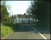
 Wartling in East Sussex lies just on the edge of the Pevensey Levels, between
Windmill Hill and Pevensey . There are two parts to the village
Wartling Hill near to the church, and about two miles away to
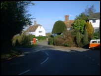
the North, lies Boreham Street which is also a very pretty village
built on the main Ninfield to Hailsham road. Wartling in East Sussex lies just on the edge of the Pevensey Levels, between
Windmill Hill and Pevensey . There are two parts to the village
Wartling Hill near to the church, and about two miles away to
the North, lies Boreham Street which is also a very pretty village
built on the main Ninfield to Hailsham road.
It was one of Haesta the Saxons boundary forts settled around 475AD
and was used to control the Pevensey Bay estuary area. It was likely
to have been a naval base as the Bay provided a protected harbour.
In the Domesday survey, it had a population of 280, land able
to support 18 ploughs, woodland for 200 pigs three salt
workings, and a chapel.
The chapel was mentioned as being given to the College of Hastings
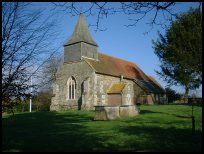
by the count of Eu. The current church dates from the 13th century,
and is believed to lie on the land where the chapel used to be.
During the late 1500's there were a large number of French
names recorded in the church register, it is probable that
they had been employed at Ashburnham and other local Furnaces
to help set up the cannon manufacturing process.
On the wall in the church are two very rare iron tombstone heads,
which were created by Jonathan Harmer of Heathfield .
During the second world war many defence pill boxes were built
in the area, to protect from invasion through the Pevensey
Marshes. One of the first Radar stations was located at manxey level.
To the east of the church, the R.A.F. had a radar control bunker
during the Cold War which was used to direct fighters onto targets by
radio. |
|
 At the church, walk to the end of the graveyard, and look
around, most of the land you see below you would have been
covered with sea water at the last millennium. To the South
East you can see Pevensey Castle , Eastbourne and the South Downs. At the church, walk to the end of the graveyard, and look
around, most of the land you see below you would have been
covered with sea water at the last millennium. To the South
East you can see Pevensey Castle , Eastbourne and the South Downs.
To get a feel for the remoteness of the area, turn East by the
church towards Hooe , and stop by the river, even today there
are not many buildings visible. This river was one of the main
export routes for the iron cannons which were cast at
Ashburnham furnace further upstream, until 1820. |
|
 Wartling in East Sussex Hill is very small, and only has the Church and
a public house for services. Wartling in East Sussex Hill is very small, and only has the Church and
a public house for services.
Boreham Street has a number of restaurants, and a garage,
and a tennis training centre. |
|
| Wartling is shown as the red symbol on the map. |
|
|
Nearby Villages
(click on symbol to see the village page) |
| Village= | |
Town= | |
Recorded in Domesday= |  |
| |
|
|
Ashburnham |
(Last Iron Furnace in Sussex) | | 3.78 miles |
|
|
Battle |
(William the Conqueror prevails) | | 6.92 miles |
|
|
Bodle Street |
(White Horse on the roof) | | 3.77 miles |
|
|
Boreham Street |
(Picturesque village on top of the Ridge) | | 1.30 miles |
|
|
Catsfield |
(Iron, Railways and Clocks) | | 4.99 miles |
|
|
Crowhurst |
(Village devastated by the Normans) | | 6.52 miles |
|
|
Folkington |
(Teasles and Badgers) | | 7.14 miles |
|
|
Hailsham |
(Ropes and Napoleon) | | 4.37 miles |
|
|
Hellingly |
(Only remaining Ciric in Sussex) | | 5.12 miles |
|
|
Herstmonceux |
(Castle and Observatory) | | 2.47 miles |
|
|
Hooe |
(The Haunt of Smugglers) | | 2.28 miles |
|
|
Ninfield |
(Last of the Iron Stocks) | | 3.59 miles |
|
|
Normans Bay |
(Last Invasion in 1066) | | 2.94 miles |
|
|
Pevensey |
(Ancient Roman Fortification) | | 2.80 miles |
|
|
Pevensey Bay |
(Fishing and Martello Towers) | | 3.01 miles |
|
|
Polegate |
(Fine old Tower Mill) | | 5.47 miles |
|
|
Westham |
(Enclosure for the Castle) | | 3.38 miles |
|
|
Windmill Hill |
(Largest Post Mill in Sussex) | | 1.83 miles |
|
|
| Copyright Villagenet 1998-2025 | |
| |
|
|
Local Interest
Just click an image |
|
|
|
|
|
|
|
|
|
|
|
|
|
|
| |