| |

|
|
|
| |
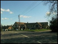
 Windmill Hill in East Sussex is located on the A271 between Boreham Street and
Herstmonceux. Windmill Hill in East Sussex is located on the A271 between Boreham Street and
Herstmonceux.
It was originally two small hamlets Posey Green and Beacon Green
both part of the Parish of Wartling .
A windmill was built probably at the beginning of the 1600's
to provide flour for the iron foundry workers at Warbleton and
Ashburnham . The first reference to the mill was on a map of
Sussex from 1783.
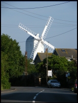
In 1814 the old mill which was owned by John Pocock was demolished
and replaced by the current windmill which is one of the largest
post mills in Sussex, and possibly throughout Britain.
In 1894 the sails were removed, and a steam engine was installed
by Neves of Warbleton to provide power.
In 1913 the mill ceased to mill corn, but was left as a landmark
for shipping in the channel to use.
From 1860 a number of brickyards and a pottery were located
in the village but became disused by the first world war.
During the First World War, the noise from the guns at the battle
of the Somme could be heard if the wind was from the south east.
In 1944 a doodlebug landed at Beacon Green demolishing the houses.
in 1993 the Windmill Hill Stores original leaded glass windows
were donated to Buckleys Yesterdays World of Battle for one of
their recreated shop fronts. |
|
 Windmill Hill in East Sussex is located on the ridge running between the hills
to the north, and the sea at Pevensey Bay . The views both north
and south are really pretty, but you need to leave the main road
and stand and look to get the best from the countryside. Windmill Hill in East Sussex is located on the ridge running between the hills
to the north, and the sea at Pevensey Bay . The views both north
and south are really pretty, but you need to leave the main road
and stand and look to get the best from the countryside.
The old mill is now rebuilt, and is worth a visit on the few
days per year that it is open. |
|
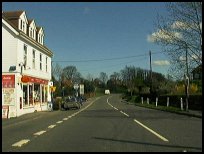
 The village has a few shops, a garage and a hotel with a view
across to the coast. A tennis training centre is in the village. The village has a few shops, a garage and a hotel with a view
across to the coast. A tennis training centre is in the village.
The nearest main shopping centre is at Hailsham about 6 miles
west. Eastbourne with its supermarkets is about 10 miles south.
The nearest train service runs from Pevensey about 6 miles south,
this is on the main Eastbourne to Hastings line. |
|
| Windmill Hill is shown as the red symbol on the map. |
|
|
Nearby Villages
(click on symbol to see the village page) |
| Village= | |
Town= | |
Recorded in Domesday= |  |
| |
|
|
Arlington |
(Peaceful Saxon Village) | | 7.08 miles |
|
|
Ashburnham |
(Last Iron Furnace in Sussex) | | 2.78 miles |
|
|
Battle |
(William the Conqueror prevails) | | 6.62 miles |
|
|
Bodle Street |
(White Horse on the roof) | | 2.00 miles |
|
|
Boreham Street |
(Picturesque village on top of the Ridge) | | 1.26 miles |
|
|
Catsfield |
(Iron, Railways and Clocks) | | 4.89 miles |
|
|
Chiddingly |
(Walking on Cheese ??) | | 6.59 miles |
|
|
Hailsham |
(Ropes and Napoleon) | | 4.04 miles |
|
|
Hellingly |
(Only remaining Ciric in Sussex) | | 4.16 miles |
|
|
Herstmonceux |
(Castle and Observatory) | | 0.88 miles |
|
|
Hooe |
(The Haunt of Smugglers) | | 2.97 miles |
|
|
Horam |
(Which Station do we get off at ?) | | 5.46 miles |
|
|
Netherfield |
(Village at the top of the Hill) | | 5.63 miles |
|
|
Ninfield |
(Last of the Iron Stocks) | | 3.69 miles |
|
|
Penhurst |
(Beautiful yet Remote) | | 3.95 miles |
|
|
Rushlake Green |
(Open Village and Nuclear Bunker) | | 4.15 miles |
|
|
Vines Cross |
(Cannons and Doodlebugs) | | 4.90 miles |
|
|
Warbleton |
(The Iron Man) | | 4.52 miles |
|
|
Wartling |
(World War II defence centre) | | 1.83 miles |
|
|
| Copyright Villagenet 1998-2025 | |
| |
|
|
Local Interest
Just click an image |
|
|
|
|
|
|
|
|
|
|
|
|
|
|
| |