|
| |
 Snave in Kent is located just off the A256 which links Ashford , via Hamstreet
to the centre of Romney Marsh at Brookland . The village only consists
of the church and two or thre houses. Snave in Kent is located just off the A256 which links Ashford , via Hamstreet
to the centre of Romney Marsh at Brookland . The village only consists
of the church and two or thre houses.
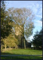
The church dedicated to Saint Augustine is one of the most remote
churches on the Romney Marsh . It is very small and stands at the
end of a deep grass track.
The church consists of a chancel with a North Chapel, nave and a
crennelated West Tower, which forms the main entrance to the church.
For the most part, the church dates from the 13th century, but the upper
part of the tower was added later. To combat the constant problem
of subsidence there are 14 buttresses around the building.
The furnishings mostly date from a restoration of 1873, similar to
other churches nearby. The Victorian pulpit and reading desk do
containsome panel work of the 15th century, possibly from an old
screen.
One of the bells was cast by Steven Norton of Maidstone, around 1380.
Only two other bells of his manufacture are known to survive.
Sadly this remote church was declared redundant, and its upkeep and
maintenance was placed in the care of the Romney Marsh Historic
Churches Trust in 1984.
St Augustine at Snave is one of those churches supported by the
Romney Marsh Historic Churches Trust . |
|
 St Augustines church is very old and peaceful, and is well worth a visit. St Augustines church is very old and peaceful, and is well worth a visit.
From the road to Snave in Kent , the full extent of the flat landscape, originally
marsh, but now rich farmland is visible to its full extent. |
|
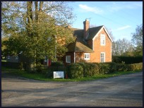
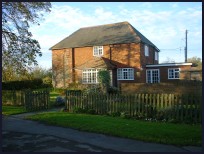 Snave in Kent has no local services , the village consists of a very
few houses and the church. Snave in Kent has no local services , the village consists of a very
few houses and the church.
The nearest train runs from Appledore station on the Hastings to
Ashford line, which runs hourly services across the Romney Marsh . |
|
| Snave is shown as the red symbol on the map. |
|
|
Nearby Villages
(click on symbol to see the village page) |
| Village= | |
Town= | |
Recorded in Domesday= |  |
| |
|
|
Aldington |
(The Aldington Gang) | | 5.17 miles |
|
|
Appledore |
(Danes invade England) | | 3.56 miles |
|
|
Bilsington |
(The Priory and Obelisk) | | 3.28 miles |
|
|
Bonnington |
(Saint Rumwold the child saint) | | 4.13 miles |
|
|
Brenzett |
(St Eanswyth a saxon princess) | | 1.82 miles |
|
|
Brookland |
(13th century wooden spire) | | 2.86 miles |
|
|
Burmarsh |
(The fortress in the Marsh?) | | 5.81 miles |
|
|
Dymchurch |
(The Romans and the sea wall) | | 5.66 miles |
|
|
Fairfield |
(The Isolated Church) | | 3.74 miles |
|
|
Hamstreet and Orlestone |
(The Start of the Ordnance Survey) | | 3.12 miles |
|
|
Iden |
(Sheriff of Kent and Jack Cade) | | 7.06 miles |
|
|
Ivychurch |
(The burial ground on the Island) | | 1.71 miles |
|
|
Kenardington |
(Danes destroy Saxon Fort) | | 3.08 miles |
|
|
Littlestone |
(The Genteel Resort) | | 5.31 miles |
|
|
Newchurch |
(The Church Tower with a kink) | | 2.81 miles |
|
|
New Romney |
(Cinque Port and Storm) | | 4.58 miles |
|
|
Old Romney |
(Sheep and Wool Smuggling) | | 3.25 miles |
|
|
Ruckinge |
(Smuggling and Traction Engines) | | 2.33 miles |
|
|
Snargate |
(Sluice Gates made by Royal Order) | | 1.58 miles |
|
|
St Mary in the Marsh |
(Ancient Celts) | | 3.61 miles |
|
|
St Marys Bay |
(Holidays and Beaches) | | 5.10 miles |
|
|
Stone in Oxney |
(Roman stone altar) | | 4.77 miles |
|
|
Warehorne |
(A good place to explore the Marshes) | | 2.13 miles |
|
|
Woodchurch |
(Dragoons capture Smugglers) | | 4.88 miles |
|
|


