| |

|
|
|
| |
 In Roman times, Bodiam in East Sussex was a main crossing point for
the road leading from Beauport near Battle to the North
Kent coast. It was also used as a port from which to
ship the Iron Ingots produced in nearby
Sedlescombe , Staplecross and Stonegate .
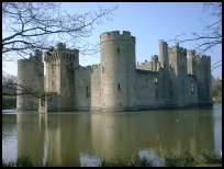
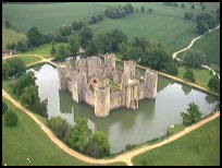
Bodiams main claim to fame is its great medieval
military fortress, the last to have been built in
England. This moated fairytale castle was built by
Sir Edward Dalyngrigge between 1385 and 1390 as a
protection to the Rother valley from the French.
Sir Edward Dalyngrigge and his wife were buried at Robertsbridge Abbey . In Roman times, Bodiam in East Sussex was a main crossing point for
the road leading from Beauport near Battle to the North
Kent coast. It was also used as a port from which to
ship the Iron Ingots produced in nearby
Sedlescombe , Staplecross and Stonegate .
Bodiams main claim to fame is its great medieval
military fortress, the last to have been built in
England. This moated fairytale castle was built by
Sir Edward Dalyngrigge between 1385 and 1390 as a
protection to the Rother valley from the French.
Sir Edward Dalyngrigge and his wife were buried at Robertsbridge Abbey .
The castle was only attacked twice, once in 1484 by
Richard III who captured it, and in 1645 by the
Roundheads led by Sir William Waller, who left it in
a partially ruined state.
From 1754 until the early 1800's, guns and cannons manufactured
at Robertsbridge were shipped from Bodiam to Woolwich Arsenal,
and other destinations.
In 1828 it was purchased by John Fuller " Mad Jack "
of Brightling from a firm of Hastings Builders,
who were demolishing it to use as building materials.
Mad Jack spent a lot of time and money repairing the
building, and replacing the main gates.
In 1917 it was acquired by Lord Curzon, who carried
out further restoration and repairs. On his death in
1925 the castle was bequeathed to the National Trust,
and can be visited, and explored to the present day.
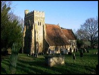
Bodiam is a small village, mostly located near the
12th Century church of St Giles on the Sandhurst road.
The only inn in the village was also built in the 14th
Century to provide food and lodgings for the visitors
to the castle, which it continues to provide to the
present day.
The Bodiam area was a main hop growing area, and in the
early parts of this century, a large number of Londoners
would come down via the railway to the Guiness hop farms
to pick the crop.
The village used to be on the Robertsbridge to Headcorn
railway line, which was axed during the 1960's by Dr
Beeching. However the steam enthusiasts from the Kent
and East Sussex Railway based in Rolvenden, have
restored the line from Tenterden to Bodiam .
The engineering on the line has been completed, and
services to Tenterden are expected to commence in
April 2000. When the line is completed, there will be No tickets
or parking available in Bodiam, and all trips will
need to be booked and commenced in Northiam or Tenterden .
The Rother Valley Railway Company, an offshoot of the
Kent and East Sussex Railway, are also hoping to restore
the branch from Robertsbridge to Bodiam , which will then
provide a continuous Steam Train link from Robertsbridge
to Tenterden . |
|
 There are many views in Bodiam in East Sussex one of the best is from
the old Railway station across the valley towards the
castle. There are many views in Bodiam in East Sussex one of the best is from
the old Railway station across the valley towards the
castle.
A second is on the Sandhurst road just before
you reach the church looking down on the castle.
In the summer a great number of hot air balloons are launched
from the Bodiam area, providing a peaceful break with their
quiet transit through the surrounding countryside.
The steam trains from the Kent and East Sussex Railway go to
the village from Northiam , Rolvenden and Tenterden . |
|
 Bodiam in East Sussex has limited services, and to to get anywhere a
car is needed, however a two hourly bus service does
run through the village from Hawkhurst to Hastings. Bodiam in East Sussex has limited services, and to to get anywhere a
car is needed, however a two hourly bus service does
run through the village from Hawkhurst to Hastings.
This makes a pleasant day trip passing the Kent & Sussex
Countryside to Bodiam . The lack of services is made up
for by the rural atmosphere.
The nearest large town is Hastings about 10 miles South,
the smaller towns of Battle approx 7 miles South West,
and Tenterden approx 7 miles North East also provide
services for the area.
The nearest railway station is at Robertsbridge , about
4 miles to the West, however most residents use
Etchingham station about 6 miles west, as there are
more stopping services. |
|
| Bodiam is shown as the red symbol on the map. |
|
|
Nearby Villages
(click on symbol to see the village page) |
| Village= | |
Town= | |
Recorded in Domesday= |  |
| |
|
|
Beckley |
(Alfred the Great and Guns !) | | 4.62 miles |
|
|
Brightling |
(famous for Mad Jack Fuller) | | 6.66 miles |
|
|
Broad Oak Brede |
(On the Crossroads) | | 4.59 miles |
|
|
Burwash |
(The home of Rudyard Kipling) | | 6.54 miles |
|
|
Cripps Corner |
(Home Guard surprises the Army) | | 2.90 miles |
|
|
Etchingham |
(The oldest Brass Weather Vane in the country) | | 4.33 miles |
|
|
Ewhurst Green |
(Great Fire of London contributions) | | 1.07 miles |
|
|
Flimwell |
(300 local people beheaded) | | 5.35 miles |
|
|
Hawkhurst |
(A Notorious Gang of Smugglers) | | 3.24 miles |
|
|
Hurst Green |
(The Youngest Highwayman on record) | | 3.15 miles |
|
|
Mountfield |
(17th Century Coal !!) | | 4.14 miles |
|
|
Newenden |
(Alfred the Great's Fort) | | 3.44 miles |
|
|
Northiam |
(Prime Ministers D Day inspection) | | 2.79 miles |
|
|
Peasmarsh |
(Black Death moves village) | | 6.39 miles |
|
|
Robertsbridge |
(The Home of Modern Cricket) | | 3.09 miles |
|
|
Rolvenden |
(Witches stealing Holy Water) | | 5.23 miles |
|
|
Salehurst |
(Richard the Lion Heart's Gift) | | 2.21 miles |
|
|
Sandhurst |
(Escape from the Great Plague) | | 1.98 miles |
|
|
Staplecross |
(Mothers grudge hangs son) | | 2.09 miles |
|
|
Ticehurst |
(Anne Boleyn and Pashley Manor) | | 6.36 miles |
|
|
| Copyright Villagenet 1998-2025 | |
| |
|
|
Local Interest
Just click an image |
|
|
|
|
|
|
|
|
|
|
|
|
|
|
| |