| |

|
|
|
| |
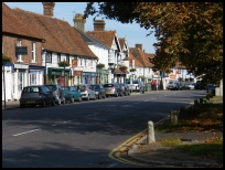
 Headcorn in Kent lies on the old A274 Tenterden to Maidstone road, and
is a long village with a wide range of local shops, and with many
old houses. Headcorn in Kent lies on the old A274 Tenterden to Maidstone road, and
is a long village with a wide range of local shops, and with many
old houses.
Its name is derived from the Saxon meaning trees cut down by Huda
to produce a clearing Hudakaruna, this has over the years changed
to Hedekaruna in 1100 then to Headcorn.
This first reference to the village is in the Domesday Monochorum
which was the churches equivalent to the Domesday Book , when the
church at Hedekaruna is mentioned as belonging to the Maidstone
dioceses.
It is said that King John (1199-1216) sat underneath the Headcorn
oak (in the churchyard) to watch bull baiting. The tree was burnt
down in the last few years.
In 1331 the export of unwashed wool was prohibited by King Edward III.
He encouraged weavers from Flanders to settle here, thus bringing
their wealth which can be seen in the houses near the church. Many of
the villages in the area, such as Cranbrook , Tenterden , Biddenden ,
Staplecross and Headcorn show signs of the wealth brought to the area.
The current church was built around 1350, with the roof timbers
sourced from the Culpepper estate at Bedgebury which lies
between Flimwell and Goudhurst .
One of Headcorn's decendants was John Willes who introduced
overarm bowling to the game of cricket, in the 1820's. He
is buried in nearby Sutton Valence .
During the early 1800's the South Eastern Railway’s track was
built through the village to provide a link from London to
Dover. This has meant that in recent years the village has
expanded quickly mostly as a commuter centre. |
|
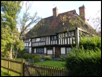
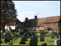
 The area by the church is the older part of the village, with a
number of very old elizabethan properties, this area is very
attractive. The area by the church is the older part of the village, with a
number of very old elizabethan properties, this area is very
attractive.
The village green is very pretty and is surrounded by old trees. |
|
 Headcorn in Kent has a wide range of shops and other services, it has
a small supermarket, and acts as a centre for other local villages. Headcorn in Kent has a wide range of shops and other services, it has
a small supermarket, and acts as a centre for other local villages.
The main line Ashford to London train line runs through the village
providing a very frequent commuter service to the capital.
Headcorn has its own airport for light aircraft and microlight
planes. It is also the local centre for parachuting. |
|
| Headcorn is shown as the red symbol on the map. |
|
|
Nearby Villages
(click on symbol to see the village page) |
| Village= | |
Town= | |
Recorded in Domesday= |  |
| |
|
|
Biddenden |
(The Maids of Biddenden) | | 3.91 miles |
|
|
Frittenden |
(The Search for the Treacle Mines) | | 2.26 miles |
|
|
Linton |
(Cavalier loses House) | | 6.05 miles |
|
|
Marden |
(Broadcloth and Agriculture) | | 5.64 miles |
|
|
Staplehurst |
(Charles Dickens train crash) | | 2.96 miles |
|
|
Sutton Valence |
(seized from Simon de Montfort) | | 3.23 miles |
|
|
| Copyright Villagenet 1998-2025 | |
| |
|
|
Local Interest
Just click an image |
|
|
|
|
|
|
|
|
|
|
|
|
|
|
| |