| |

|
|
|
| |
 Hurst Green in East Sussex lies about 2 miles north of Robertsbridge
on the A21, the busy main road from London to Hastings. Hurst Green in East Sussex lies about 2 miles north of Robertsbridge
on the A21, the busy main road from London to Hastings.
It is possible that the area known as Burgh Hill, on the
south side of the village was the site of a fort built by
King Alfred the Great . The fort could have been Eorpeburner /Eorpeburnan (possibly
meaning Legion fortress) , this is mentioned in the Burghal Hidage ,
a record of the forts from Alfreds reign. Currently no one has
found the site of this fort although it may be at Newenden . In the Saxon Chronicles
in 892 the Vikings stormed and destroyed the fort which was found on the river Rother / Limen .
Burgh Hill is on a very steep hill overlooking the Rother valley, and would
make a good defensive position overlooking the tidal rother . During
the 800's the Sea Level was higher in the area, and the Viking
longboats could have sailed up the Rother valley from their base
at Appledore which they created in 892.
The Fledgling Wealden iron industry based around this area at old Roman
iron working bloomeries such as that found at Stonegate would have transported
their goods from Etchingham or Robertsbridge as the Limen / Rother was navigable
at this point. The Name Eorpeburnan (Legion fortress) could refer to the use of the
Roman bloomeries around the area, or possibly that Eorpeburna provided masses of
weapons to the kingdom of Wessex.
However the other translation for the word Burgh means high so it could just be a high hill.
In 1264 King Henry III( see also Flimwell ) passed
through Hurst Green with his army on the way to Lewes.
In 1744 the village green covered a triangular area
from the courthouse to the village hall, including
land on which some houses in Station Road stand.
'The Cottage' and 'Yew Tree' are shown on a map dated
1650, and so must have stood on the edge of the Village
Green.
The notorious Hawkhurst Gang of smugglers used to
terrorise the area. In 1740, at Silver Hill between
Hurst Green and Robertsbridge a Revenue Officer
Thomas Carswell was shot and killed while trying
to apprehend some of the smugglers. One of the guilty
smugglers George Chapman was gibbetted in his home
village Hurst Green on the village green, no doubt
watched by many of the locals as in its time it was
a popular spectator sport!
A few years later in 1796, Richard Russel, possibly
the youngest highwayman on record at 13 years of age,
was charged at the assizes for robbing the Hurst Green
mail. He stole a draft to the value of £32 14s 0d,
the property of a Mountfield man James Bourne. In
consideration of his age he was only jailed for 6 months.
The village had its hey-day in the 19th and early 20th
centuries, when it had many shops and local businesses,
but declined during the post World War II period, with
the advent of the motor car and large super stores.
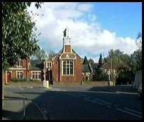
At the end of Station Road stands the Court House,
built in 1892 on the site of the old Toll Gate Cottage.
The Toll Gate stood at the junction of the roads from
London, Hastings and Etchingham . The Toll Cottage had
a large lantern which was maintained by public
subscription, the forerunner of local street lighting.
The Court House has a clock tower, which was erected in
memory of Mr Gregory of Boarzell. The clock has 3 faces,
each measuring 4ft in diameter, and it used to strike
the hours on a bell weighing two hundred weight. In no
longer does this, as at night the chiming was an
annoyance to the local people. The building ceased to
be a court house about 1973. |
|
 From the A21 road heading south of Hurst Green in East Sussex towards
Hastings, to your right just after passing the school
the Rother Valley in all its splendour winds westward
upstream towards Mayfield . From the A21 road heading south of Hurst Green in East Sussex towards
Hastings, to your right just after passing the school
the Rother Valley in all its splendour winds westward
upstream towards Mayfield .
Travelling south towards Etchingham via the Burgh Hill
road, the full beauty of the Rother valley is before
you. |
|
 Hurst Green in East Sussex has a few shops and Public Houses which
provide the usual village services. Hurst Green in East Sussex has a few shops and Public Houses which
provide the usual village services.
The main Hawkhurst to Battle , and Hurst Green
to Heathfield bus services go through the village
centre.
The nearest train service is from Etchingham with
a 20 minute service to London in the rush hour, and
hourly in between.
The small town of Battle is about 6 miles South, and
has a wide variety of shops. The main towns of Hastings
about 14 miles South, and Tunbridge Wells approx 15
miles North provide supermarket access. |
|
| Hurst Green is shown as the red symbol on the map. |
|
|
Nearby Villages
(click on symbol to see the village page) |
| Village= | |
Town= | |
Recorded in Domesday= |  |
| |
|
|
Benenden |
(One of Englands Top Girls Schools) | | 5.96 miles |
|
|
Bodiam |
(The finest ruined castle in the Country) | | 3.15 miles |
|
|
Brightling |
(famous for Mad Jack Fuller) | | 4.85 miles |
|
|
Burwash |
(The home of Rudyard Kipling) | | 3.78 miles |
|
|
Burwash Common |
(Roughest pub in the South East) | | 6.08 miles |
|
|
Burwash Weald |
(Roughest pub in the South East) | | 5.66 miles |
|
|
Cripps Corner |
(Home Guard surprises the Army) | | 4.65 miles |
|
|
Etchingham |
(The oldest Brass Weather Vane in the country) | | 1.47 miles |
|
|
Ewhurst Green |
(Great Fire of London contributions) | | 4.12 miles |
|
|
Flimwell |
(300 local people beheaded) | | 2.74 miles |
|
|
Hawkhurst |
(A Notorious Gang of Smugglers) | | 2.66 miles |
|
|
Newenden |
(Alfred the Great's Fort) | | 6.32 miles |
|
|
Northiam |
(Prime Ministers D Day inspection) | | 5.93 miles |
|
|
Punnetts Town |
(The Windmill on the Hill) | | 7.67 miles |
|
|
Robertsbridge |
(The Home of Modern Cricket) | | 2.26 miles |
|
|
Salehurst |
(Richard the Lion Heart's Gift) | | 2.03 miles |
|
|
Sandhurst |
(Escape from the Great Plague) | | 4.14 miles |
|
|
Staplecross |
(Mothers grudge hangs son) | | 4.24 miles |
|
|
Stonegate |
(Ancient Roman Cross Road) | | 4.15 miles |
|
|
Ticehurst |
(Anne Boleyn and Pashley Manor) | | 3.29 miles |
|
|
Wadhurst |
(Last bare fisted Prize-Fight in England) | | 6.50 miles |
|
|
| Copyright Villagenet 1998-2025 | |
| |
|
|
Local Interest
Just click an image |
|
|
|
|
|
|
|
|
|
|
|
|
|
|
| |