| |

|
|
|
| |
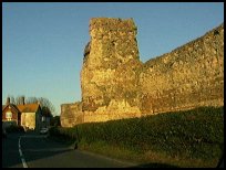
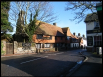
 Pevensey in East Sussex is a small village which was built on the east side
of Pevensey Castle walls, its history is tied in very closely
with the Castle.
Its name comes from the Saxon 'Pefe Ie' , and translates to
the 'Island of Pefe' in time this has degenerated to Pefeie
then Pevensey. In Roman times, the sea lapped around the base
of the castle, since then the sea has retreated, and is now
about 2 miles away at Pevensey Bay . Pevensey in East Sussex is a small village which was built on the east side
of Pevensey Castle walls, its history is tied in very closely
with the Castle.
Its name comes from the Saxon 'Pefe Ie' , and translates to
the 'Island of Pefe' in time this has degenerated to Pefeie
then Pevensey. In Roman times, the sea lapped around the base
of the castle, since then the sea has retreated, and is now
about 2 miles away at Pevensey Bay .
Pevensey Castle was built by the Romans between 250 and 300AD
to defend the coast against the Franks and Alemanni who were
attacking the Roman Empire in northern europe. It was built on
the Island, and was known as Anderida. During the times
of Alfred the Great the fortifications were known as
Andredceaster .
When the Roman Legions withdrew from Britain in 408AD, the
castle was occupied by the Anglo-Saxons, until it was seized
in 491AD by Aella the Saxon. ( see also Ashburnham )
In 1042 and 1049, the castle was raided by Earl Godwine, soon
to become Harold II, and during the Spring and Summer of 1066
the castle was occupied by Harold's army, who were expecting
William's forces.
Many scholars believe that the Normans landed at Pevensey
in October 1066 , but from research we have carried out it
seems less likely. However Pevensey was occupied by the Normans
in late 1066 .
In the Domesday book it is mentioned as Pevensey, which
appeared to be untouched by the Conquerors men during
1066 .
The castle was besieged, probably from the Westham side,
as a narrow spit of land joined the castle to the mainland,
by William Rufus(1087 - 1100) and King Stephen(1135 - 1141).
Simon De Montfort(1264) on his way from Lewes failed to take
the castle, and in 1399 it was again attacked this time by
the Yorkists.
Pevensey became part of the Cinque Ports as a 'Limb of Hastings',
and from Norman times had its own mint, the old Mint House
lies opposite the gates and dates from 1342.
In 1393 Sir John Pelham (one of the knights who it was said
captured the King of France at the Battle of Poitiers in 1356) was
appointed as the Constable of Pevensey Castle .
Queen Elizabeth I ordered the castle to be demolished, but
this was ignored, and then in the Cromwellian period, the
castle was sold to a builder for demolition. Luckily only
a small amount of stones were removed, before the crown
seized it in 1660 after the Restoration.
During the Second World War the castle had its towers
reinforced, and camouflaged pill boxes constructed within
the castle. |
|
 From the castle looking south, you can see some of the
Martello Towers built along the coastline in the early
1800's as defense from Napoleon . From the castle looking south, you can see some of the
Martello Towers built along the coastline in the early
1800's as defense from Napoleon .
To the west are the magnificent South Downs , and Eastbourne .
To the east are the deserted areas of the Pevensey in East Sussex Levels ,
where smugglers would bring in their cargoes, when the
area was under water. The 1066 Country Walk runs through the village. |
|
 Pevensey in East Sussex itself has a few local village services, but has
a museum, some public houses, and restaurants. Pevensey in East Sussex itself has a few local village services, but has
a museum, some public houses, and restaurants.
Further services are available at Westham on the other side
of the castle, including the main line trains with a regular
service from Hastings to Eastbourne .
The main shopping centre is at Eastbourne about 3 miles
south west. |
|
| Pevensey is shown as the red symbol on the map. |
|
|
Nearby Villages
(click on symbol to see the village page) |
| Village= | |
Town= | |
Recorded in Domesday= |  |
| |
|
|
Arlington |
(Peaceful Saxon Village) | | 6.71 miles |
|
|
Boreham Street |
(Picturesque village on top of the Ridge) | | 4.08 miles |
|
|
Folkington |
(Teasles and Badgers) | | 5.75 miles |
|
|
Friston |
(Home of the Railway Children) | | 7.14 miles |
|
|
Hailsham |
(Ropes and Napoleon) | | 4.79 miles |
|
|
Hooe |
(The Haunt of Smugglers) | | 4.41 miles |
|
|
Jevington |
(Smugglers and Churchill Tanks) | | 5.84 miles |
|
|
Normans Bay |
(Last Invasion in 1066) | | 2.42 miles |
|
|
Pevensey Bay |
(Fishing and Martello Towers) | | 0.28 miles |
|
|
Polegate |
(Fine old Tower Mill) | | 4.22 miles |
|
|
Wartling |
(World War II defence centre) | | 2.80 miles |
|
|
Westham |
(Enclosure for the Castle) | | 0.79 miles |
|
|
Wilmington |
(The Long Man) | | 6.51 miles |
|
|
| Copyright Villagenet 1998-2025 | |
| |
|
|
Local Interest
Just click an image |
|
|
|
|
|
|
|
|
|
|
|
|
|
|
| |