| |

|
|
|
| |
 Littlestone in Kent lies on the coast between Greatstone and St Marys Bay at the end of the
Dymchurch wall, the sea defences built by the Romans . The name is derived from the
fact that the shingle swept up on the beach was smaller than that of Greatstone and
Dungeness to the west . Littlestone in Kent lies on the coast between Greatstone and St Marys Bay at the end of the
Dymchurch wall, the sea defences built by the Romans . The name is derived from the
fact that the shingle swept up on the beach was smaller than that of Greatstone and
Dungeness to the west .
The river Rother came to the sea at this point until 1287 when a storm blocked the
entrance of the Rother and flooded New Romney , which lies just inland.
A lifeboat was launched from the beach from 1858 until 1928.
The village of Littlestone was started in the 1880's by Sir Robert Perks
at the point where the lifeboat was launched , as a resort for the gentry.
The Grand Hotel and a terrace of houses mark the spot he decided to create
the new resort. He laid out the Littlestone golf course to go with the
resort, but the tourists didn't come in the numbers needed. The 120ft high
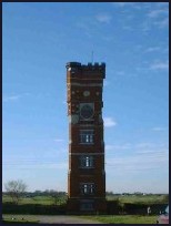
red brick watertower was built in 1890 to provide water to the resort, it is
now a landmark to point out the village from far around.
On the 16th July 1927, the Romney Hythe and Dymchurch Railway (RHDR) a narrow gauge railway
was opened, Littlestone lies about 1/2 mile south of the main headquarters
of the railway at New Romney . During 1928, the nameboards at the New Romney station
were changed to read 'Littlestone-on-Sea' in an effort to emphasise the railway's seaside
location.
The railway was built by Captain J. E. P. Howey and Count Louis Zborowski to
serve the local population and tourist trade, it stretches for nearly 14 miles
from Hythe through Dymchurch , St Marys Bay ,its base at New Romney ,Romney Sands
and then to the fishermens cottages and lighthouses at Dungeness . It is still
a major tourist attraction and well worth a visit.
(Click here for the Official RHDR site)
Out to sea, lies a section of the Concrete Mulberry Harbour built during 1944
for the Dunkirk landings in the Second World War. This section became detached
from its tug and drifted back to Littlestone . |
|
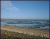
 The view from the Dymchurch wall provides beautiful vistas across the sea to
Dungeness in the west and to Hythe in the east. The sands on beach at low tide
spread out about 1/2 miles from the sea wall. Out to sea, lies a section of
the Mulberry Harbour used during the Dunkirk landings, that became detached
from its tug and drifted back to Littlestone in Kent . The view from the Dymchurch wall provides beautiful vistas across the sea to
Dungeness in the west and to Hythe in the east. The sands on beach at low tide
spread out about 1/2 miles from the sea wall. Out to sea, lies a section of
the Mulberry Harbour used during the Dunkirk landings, that became detached
from its tug and drifted back to Littlestone in Kent .
The old brick water tower in the middle of the village is visible from miles
around over the flat marshes. |
|
 Littlestone in Kent has few services but nearby New Romney and Greatstone provide
village services. Littlestone in Kent has few services but nearby New Romney and Greatstone provide
village services.
The Romney Hythe and Dymchurch Railway provide the nearest train services,
but the main line runs from Appledore station about 8 miles north west. |
|
| Littlestone is shown as the red symbol on the map. |
|
|
Nearby Villages
(click on symbol to see the village page) |
| Village= | |
Town= | |
Recorded in Domesday= |  |
| |
|
|
Brenzett |
(St Eanswyth a saxon princess) | | 5.03 miles |
|
|
Brookland |
(13th century wooden spire) | | 5.62 miles |
|
|
Broomhill |
(Swept away by the Storm) | | 7.40 miles |
|
|
Dymchurch |
(The Romans and the sea wall) | | 3.52 miles |
|
|
Greatstone |
(Parabolic Sound Detectors and PLUTO) | | 1.59 miles |
|
|
Ivychurch |
(The burial ground on the Island) | | 3.76 miles |
|
|
Lydd |
(The Cathedral of the Marsh) | | 3.33 miles |
|
|
Lydd on Sea |
(Bungalows and Fishermen) | | 2.82 miles |
|
|
New Romney |
(Cinque Port and Storm) | | 0.96 miles |
|
|
Old Romney |
(Sheep and Wool Smuggling) | | 2.92 miles |
|
|
Snargate |
(Sluice Gates made by Royal Order) | | 5.96 miles |
|
|
Snave |
(the Remote church) | | 5.31 miles |
|
|
St Mary in the Marsh |
(Ancient Celts) | | 2.13 miles |
|
|
St Marys Bay |
(Holidays and Beaches) | | 1.85 miles |
|
|
| Copyright Villagenet 1998-2025 | |
| |
|
|
Local Interest
Just click an image |
|
|
|
|
|
|
|
|
|
|
|
|
|
|
| |