| |

|
|
|
| |
 Dymchurch in Kent lies on the A259 Hastings to Folkestone road between Hythe and
St Marys Bay .
The Dymchurch wall (sea defences) were built by the Romans to protect their
harbour at Port Lympne they run for about 4 miles and were about 20 ft high.
The Saxons were here between 400 - 1000 AD see the place name derivation,
possibly using the area as an execution site for criminals. Dymchurch in Kent lies on the A259 Hastings to Folkestone road between Hythe and
St Marys Bay .
The Dymchurch wall (sea defences) were built by the Romans to protect their
harbour at Port Lympne they run for about 4 miles and were about 20 ft high.
The Saxons were here between 400 - 1000 AD see the place name derivation,
possibly using the area as an execution site for criminals.
The effect of this wall together with the Rhee Wall they erected between
New Romney and Appledore ensured that the rich alluvial land deposited by
the river Limen ( Rother ) initially used as salt pans, slowly through
time became rich and fertile farmland.
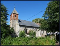
The Normans built the small parish church of St Peter and St Paul, and it still
keeps its ancient feel.
In the 1100's the right to the self governing of the land in this area was given
to a body called Lex Marisci, in exchange for these people to keep the sea wall
maintained. In 1250 saw the creation of the Jurats of the Level of Romney Marsh ,
an ancient organisation who like the Cinque Ports were allowed the privilege of
governing themselves in exchange for the sea wall maintenance, its headquarters
were at Dymchurch.
The church has been used for storing smuggled goods as were most of the others on
Romney Marsh . This started in the reign of Edward I, about 1300, when a
customs duty was placed on the export of wool, which was in great demand in Europe.
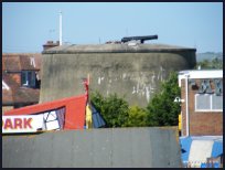
Dymchurch was part of the Napoleonic defenses of England in the early 1800's. Two
Martello towers were built in the Village act as a deterrent to Napoleon invading.
At the time, the only people who lived here were a few fishermen, or smugglers.
In 1908 Walter Jerrold described the village as quiet scattered village and a
delightful place far from the madding crowd.
The book Dr Syn written by Russell Thorndike helps to give the feel of the marshes,
its smuggling and owling, the church described in the book is that in Dymchurch .
On the 16th July 1927, the Romney Hythe and Dymchurch Railway (RHDR) a narrow gauge railway
was opened, during the war the army requisitioned the line and Dymchurch station
became the Commanding Officer's base. The armoured train was based near here.
The railway was built by Captain J. E. P. Howey and Count Louis Zborowski to
serve the local population and tourist trade, it stretches for nearly 14 miles
from Hythe through Dymchurch , St Marys Bay ,its base at New Romney ,Romney Sands
and then to the fishermens cottages and lighthouses at Dungeness . It is still
a major tourist attraction and well worth a visit.
(Click here for the Official RHDR site)
Today Dymchurch is a bustling holiday centre with its Amusement Arcades and
attractions.
St Peter & St Paul is one of those churches supported by the
Romney Marsh Historic Churches Trust . |
|
 From the top of the Dymchurch in Kent wall there are fine views of the White Cliffs
at Folkestone and Dover. To the north are the hills near Lympne . In the
distance to the west lies the bulk of the nuclear power stations at
Dungeness . From the top of the Dymchurch in Kent wall there are fine views of the White Cliffs
at Folkestone and Dover. To the north are the hills near Lympne . In the
distance to the west lies the bulk of the nuclear power stations at
Dungeness .
The Martello tower in the village is open to the public during the summer
and is quite interesting.
The Romney Hythe and Dymchurch railway has a stop in the village which
will carry visitors to Dungeness , New Romney , St Marys Bay and Hythe
by miniature steam train. |
|
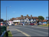
 Dymchurch in Kent is quite a large village which spreads along the A259 it has
a wide range of services , and is mostly geared towards the holidaymaker. Dymchurch in Kent is quite a large village which spreads along the A259 it has
a wide range of services , and is mostly geared towards the holidaymaker.
The nearest main shopping centre is in Folkestone about 6 miles to the East. |
|
| Dymchurch is shown as the red symbol on the map. |
|
|
Nearby Villages
(click on symbol to see the village page) |
| Village= | |
Town= | |
Recorded in Domesday= |  |
| |
|
|
Bilsington |
(The Priory and Obelisk) | | 4.96 miles |
|
|
Bonnington |
(Saint Rumwold the child saint) | | 4.56 miles |
|
|
Brenzett |
(St Eanswyth a saxon princess) | | 6.47 miles |
|
|
Burmarsh |
(The fortress in the Marsh?) | | 1.26 miles |
|
|
Hamstreet and Orlestone |
(The Start of the Ordnance Survey) | | 7.41 miles |
|
|
Ivychurch |
(The burial ground on the Island) | | 4.96 miles |
|
|
Littlestone |
(The Genteel Resort) | | 3.52 miles |
|
|
Lympne |
(From Roman Castle to Tigers) | | 3.41 miles |
|
|
Newchurch |
(The Church Tower with a kink) | | 3.14 miles |
|
|
New Romney |
(Cinque Port and Storm) | | 4.01 miles |
|
|
Old Romney |
(Sheep and Wool Smuggling) | | 5.26 miles |
|
|
Ruckinge |
(Smuggling and Traction Engines) | | 5.44 miles |
|
|
Snave |
(the Remote church) | | 5.66 miles |
|
|
St Mary in the Marsh |
(Ancient Celts) | | 2.60 miles |
|
|
St Marys Bay |
(Holidays and Beaches) | | 1.68 miles |
|
|
| Copyright Villagenet 1998-2025 | |
| |
|
|
Local Interest
Just click an image |
|
|
|
|
|
|
|
|
|
|
|
|
|
|
| |