Nearby Villages
(click on symbol to see the village page) |
| Village= | |
Town= | |
Recorded in Domesday= |  |
|
|
|
|
Ashurst |
(Miraculous Carving) | | 3.25 miles |
|
|
Blackham |
(Roughs and Prize Fighters) | | 2.64 miles |
|
|
Chiddingstone |
(A perfect Tudor village) | | 2.21 miles |
|
|
Chiddingstone Causeway |
(Penshurst Station ??) | | 3.65 miles |
|
|
Edenbridge |
(Roman Crossing to Victorian Bridge) | | 2.82 miles |
|
|
Fordcombe |
(Paper Mill and the Field Marshal) | | 3.61 miles |
|
|
Groombridge |
(Home of the Groombridge Gang) | | 4.98 miles |
|
|
Hever |
(Anne Boleyn and the Castle) | | 1.34 miles |
|
|
Langton Green |
(Modern village and Old Quarry) | | 5.19 miles |
|
|
Rusthall |
(The Toad Rock) | | 5.64 miles |
|
|
Speldhurst |
(Nobleman captured at Agincourt) | | 4.93 miles |


 Our General section is under preparation
 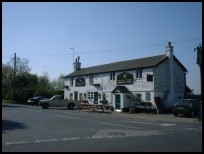 Our Views section is under preparation
  Our Services section is under preparation