| |

|
|
|
| |
 Pembury in Kent is a split village about 2 miles to the north of
Royal Tunbridge Wells . The old village by the church is found
towards Tonbridge and the new part of the village the Upper Green
about 2 miles away towards Matfield . Pembury in Kent is a split village about 2 miles to the north of
Royal Tunbridge Wells . The old village by the church is found
towards Tonbridge and the new part of the village the Upper Green
about 2 miles away towards Matfield .
The name of Pembury is most likely derived from the Saxon Pepingbeorg the
hill of the Pepings , or perhaps Pepingeberia meaning the
Pippin Apple Tree(Bush).
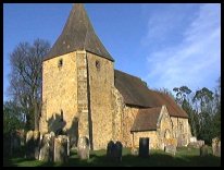
It is believed that the old church was started in the late 11th
century but the majority of the structure was built by John
Colepeper in the 1330's.
Pembury is linked to 2 manors Hawkwell(Pepenbury Magna) to the
north of the village on the Paddock Wood road. The building was
destroyed by fire, and a ghost story has come from this disaster.
'Many years ago the owner of Hawkwell died, and left two
daughters and a widow. The family was considered rich, and one of
the daughters married an adventurer who took her to London . The
daughter was very badly treated, and decided to escape back to
Hawkwell with her 3 month old child. It was a very cold day, and
she had no transport, so she walked. It was dark before she got
back to the Manor, only to find it had been destroyed by the fire.
She was exhausted and collapsed nearby. At the same time her
now old and infirm mother and daughter had moved to a nearby
house, and were about to celebrate the mothers birthday. The
old lady would not allow the celebrations to take place, as
she said she was waiting for her younger daughter to arrive.
The guests at the party thought she was mad as her daughter
was miles away in London. The olds lady collapsed, and her last
words were that 'She has come, she has come'. Later that evening
some labourers foud the younger daughter frozen to death by
the ruins of the manor. Since then it is said that the
young daughters ghost is still searching for her family.
The other manor Bayhall(Pepenbury Parva) lay south of the current
A21 and was built before 1337 by the Colepeper family.
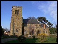
During the 1820's with the coming of the stagecoach, the Upper
Green came to prominance as a staging post for travellers from
London to Hastings. The Upper Green is about 2 miles from the old
village, and has its own church built in 1847. The lower end of
the Upper Green was well known for its smuggling links with
the Hawkhurst Gang .
Also during the early 1800's at the Lower Green near to Hawkwell
was found a seam of brickmaking clay, and a brickworks was built
which continued manufacturing until the Second World War .
Some years after the seam of clay was discovered, a pottery was
started, which used left over twigs from hop poles to fire the
pots. Once the farmers started to train the hops up poles, then
the source of the twigs ceased, and the pottery closed.
In 1830 a workhouse and Infirmary was built on the Tonbridge road
which is now the Pembury Hospital.
During the latter part of the 20th century many housing estates
have been built in the area, and the two older settlements
of the Upper and Lower Green's have merged. |
|
 The area around the old church is quiet peaceful and very pretty. The area around the old church is quiet peaceful and very pretty.
The Paddock Wood road has a number of very pretty spots within
the village.
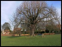
The Upper Green is open and surrounded by attractive buildings. |
|
 Pembury in Kent is just off the main A21, giving access to London and
Hastings. There are a number of shops within Pembury , most
items can be got in the village. Pembury in Kent is just off the main A21, giving access to London and
Hastings. There are a number of shops within Pembury , most
items can be got in the village.
The main shopping centre is at Royal Tunbridge Wells with
supermarkets and a large shopping mall.
The nearest trains are at Royal Tunbridge Wells , however
the best parking for the trains is at Tonbridge a few miles to the
north west. |
|
| Pembury is shown as the red symbol on the map. |
|
|
Nearby Villages
(click on symbol to see the village page) |
| Village= | |
Town= | |
Recorded in Domesday= |  |
| |
|
|
Bells Yew Green |
(The ruins of Bayham Abbey) | | 3.43 miles |
|
|
Brenchley |
(A beautiful Kent village) | | 2.96 miles |
|
|
Chiddingstone Causeway |
(Penshurst Station ??) | | 7.51 miles |
|
|
Eridge Green |
(The home of the Neville Family) | | 5.72 miles |
|
|
Fordcombe |
(Paper Mill and the Field Marshal) | | 6.44 miles |
|
|
Frant |
(King Johns hunting lodge) | | 4.38 miles |
|
|
Goudhurst |
(Smugglers, Iron and Forests) | | 6.12 miles |
|
|
Groombridge |
(Home of the Groombridge Gang) | | 6.69 miles |
|
|
Horsmonden |
(The largest Wealden Iron Works) | | 4.46 miles |
|
|
Kilndown |
(Charcoal for the Furnace) | | 5.77 miles |
|
|
Lamberhurst |
(Scotney Castle and Gardens) | | 4.29 miles |
|
|
Langton Green |
(Modern village and Old Quarry) | | 5.14 miles |
|
|
Matfield |
(Largest Village Green in Kent) | | 1.66 miles |
|
|
Paddock Wood |
(Railway brings prosperity) | | 3.39 miles |
|
|
Rusthall |
(The Toad Rock) | | 4.41 miles |
|
|
Speldhurst |
(Nobleman captured at Agincourt) | | 4.77 miles |
|
|
Tudeley and Capel |
(Iron Industry and Hop Pickers) | | 2.29 miles |
|
|
| Copyright Villagenet 1998-2025 | |
| |
|
|
Local Interest
Just click an image |
|
|
|
|
|
|
|
|
|
|
|
|
|
|
| |