| |

|
|
|
| |
 Kilndown in Kent lies a comfortable one mile from the A21 London to
Hastings road, about 3 miles from Goudhurst to the north, and
about 4 miles from Lamberhurst to the west. Kilndown in Kent lies a comfortable one mile from the A21 London to
Hastings road, about 3 miles from Goudhurst to the north, and
about 4 miles from Lamberhurst to the west.
The village is tied into the the Bedgebury estate which is one of
the oldest in Kent dating from 815AD, lying between Hawkhurst to
the east, Flimwell to the south, Kilndown to the west and
Goudhurst to the north. William the Conqueror gave the manor to the
de Bedgebury family who owned it until 1450 , when the Culpepper
family acquired the land. Queen Elizabeth I knighted Alexander
Culpepper in 1573 when she stayed at the estate. The estate was
famous for its Iron Workings and furnace.
Kilndown was originally a village producing charcoal and workers
to the estate, then in 1836 Bedgebury was purchased by Field
Marshal Viscount Beresford, one of the field commanders of
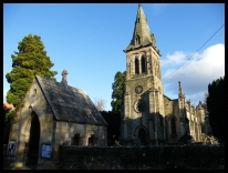
Wellington in the Napoleonic Wars. The church was built in 1841,
to provide nearby religious services for the estate workers, prior
to this they had to make their way up the hill to Goudhurst .
During the Second World War bombs landed in the village just south
of the church and destroyed the south facing windows. |
|
 Kilndown in Kent has a number of very pretty views, as the area around
is very rural. Kilndown in Kent has a number of very pretty views, as the area around
is very rural.
Take the Goudhurst road, and the views across the valley to the
village on the hill is beautiful. This can also be seen from the
cricket pitch which holds regular boot sales.
The road towards Bedgebury is very narrow, but very attractive
and you can imagine Kentish roads from the past, as you drive
up and down the hills. |
|
 Kilndown in Kent has a local public house and church, the Quarry Centre
provides a shop and Post office on a Wednesday from 9am till 12 noon
and also an Organic Shop on Saturdays from 10am till 12 noon. Kilndown in Kent has a local public house and church, the Quarry Centre
provides a shop and Post office on a Wednesday from 9am till 12 noon
and also an Organic Shop on Saturdays from 10am till 12 noon.
The nearest main shopping centre is Royal Tunbridge Wells which
has many shops and supermarkets .
The nearest main line trains run from Marden about 8 miles away
to the north, and provide regular services from Ashford to London .
An infrequent bus service runs to Tunbridge Wells twice weekly
and also to Maidstone on a Tuesday and Rye on Thursday. |
|
| Kilndown is shown as the red symbol on the map. |
|
|
Nearby Villages
(click on symbol to see the village page) |
| Village= | |
Town= | |
Recorded in Domesday= |  |
| |
|
|
Bells Yew Green |
(The ruins of Bayham Abbey) | | 5.70 miles |
|
|
Benenden |
(One of Englands Top Girls Schools) | | 6.99 miles |
|
|
Brenchley |
(A beautiful Kent village) | | 4.16 miles |
|
|
Cranbrook |
(Christmas Cards and Union Mill) | | 4.84 miles |
|
|
Flimwell |
(300 local people beheaded) | | 2.71 miles |
|
|
Goudhurst |
(Smugglers, Iron and Forests) | | 2.01 miles |
|
|
Hawkhurst |
(A Notorious Gang of Smugglers) | | 4.77 miles |
|
|
Horsmonden |
(The largest Wealden Iron Works) | | 3.31 miles |
|
|
Lamberhurst |
(Scotney Castle and Gardens) | | 1.63 miles |
|
|
Matfield |
(Largest Village Green in Kent) | | 4.72 miles |
|
|
Pembury |
(The ghost of Hawkwell) | | 5.77 miles |
|
|
Sissinghurst |
(The magnificent garden of Vita Sackville-West) | | 5.94 miles |
|
|
Ticehurst |
(Anne Boleyn and Pashley Manor) | | 3.26 miles |
|
|
Wadhurst |
(Last bare fisted Prize-Fight in England) | | 4.40 miles |
|
|
| Copyright Villagenet 1998-2025 | |
| |
|
|
Local Interest
Just click an image |
|
|
|
|
|
|
|
|
|
|
|
|
|
|
| |