| |

|
|
|
| |
 Chiddingstone Causeway in Kent lies between Leigh and Edenbridge on the
B2027 .
The village is a relatively modern one which has sprung up around
Penshurst station, which was built to provide rail access to
Penshurst Place. The railways in the area were built during the 1850's
to provide easy access to London, Tonbridge and Sevenoaks. Chiddingstone Causeway in Kent lies between Leigh and Edenbridge on the
B2027 .
The village is a relatively modern one which has sprung up around
Penshurst station, which was built to provide rail access to
Penshurst Place. The railways in the area were built during the 1850's
to provide easy access to London, Tonbridge and Sevenoaks.
Because of the trains providing access to Penshurst Place, a community
grew up to service the famous and wealthy visitors attending. Initially
with transport, then small businesses sprung up, and shipping firms to
transport farm goods to the towns.
In the 1860's the firm of Duke and Sons started to make cricket bats and
balls for Penshurst Place, then due to the proximity of the railway to
sell further afield.
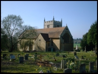
Because of the population increases a church was built of corrugated iron,
the congregations increased until a stone church was erected and dedicated
in 1898. The church was built within the parish of Chiddingstone , hence the
village name is derived from Chiddingstone and not Penshurst which is the
name of the station which is located next to the church.
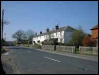
Nowadays the village is mostly housing, and the local businesses are
small and rural. |
|
 Chiddingstone Causeway in Kent lies in a pleasant rural location,
the hills all around are very attractive. Chiddingstone Causeway in Kent lies in a pleasant rural location,
the hills all around are very attractive.
The prettiest area is on the Penshurst road with some nice
rural views. |
|
 Chiddingstone Causeway in Kent has few local services, the church
providing spiritual relief. Chiddingstone Causeway in Kent has few local services, the church
providing spiritual relief.
The station in the village provides access east to Tonbridge
and west to Edenbridge.
The nearest local shopping centre lies at Edenbridge about 5
miles west, or the major centre of Tonbridge about three miles
to the east. |
|
| Chiddingstone Causeway is shown as the red symbol on the map. |
|
|
Nearby Villages
(click on symbol to see the village page) |
| Village= | |
Town= | |
Recorded in Domesday= |  |
| |
|
|
Chiddingstone |
(A perfect Tudor village) | | 1.44 miles |
|
|
Edenbridge |
(Roman Crossing to Victorian Bridge) | | 4.83 miles |
|
|
Fordcombe |
(Paper Mill and the Field Marshal) | | 3.94 miles |
|
|
Hever |
(Anne Boleyn and the Castle) | | 2.97 miles |
|
|
Pembury |
(The ghost of Hawkwell) | | 7.51 miles |
|
|
Sevenoaks Weald |
(Lower the tower by twenty feet) | | 2.97 miles |
|
|
Speldhurst |
(Nobleman captured at Agincourt) | | 3.77 miles |
|
|
| Copyright Villagenet 1998-2025 | |
| |
|
|
Local Interest
Just click an image |
|
|
|
|
|
|
|
|
|
|
|
|
|
|
| |