| |

|
|
|
| |
 Langton Green in Kent lies on the A Tunbridge Wells to East Grinstead road,
between Rusthall , Groombridge , Speldhurst and Eridge . Langton Green in Kent lies on the A Tunbridge Wells to East Grinstead road,
between Rusthall , Groombridge , Speldhurst and Eridge .
The area provided work for a long time as a farming and a quarrying area,
the quarry lies about 1/2 mile towards Speldhurst . Stone from this quarry
was used to rebuild Speldhurst church after it was destroyed by lightning,
the church in the village and that of Rusthall were also built from the
sandstone quarried here.
The area used to be called Lankton and was in the parish of Speldhurst ,
but the main road through the village created business, and the village
formed to provide services to travellers alongside the green.
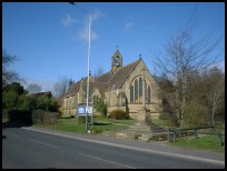
The village used to lie in the Parish of Speldhurst , but in the early
1860's a Chapel of Ease was built and was consecrated as a church which
is now All Saints in 1881.
The village is now a satellite of Tunbridge Wells and merges with
Rusthall providing housing for commuters and workers for Tunbridge Wells . |
|
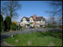
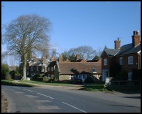
 Langton Green in Kent has some nice lanes surrounding the green. Langton Green in Kent has some nice lanes surrounding the green.
The road to Speldhurst is quite pretty, but the best views are
down the road to Eridge and the High Rocks, with some very twisty
small lanes and steep fields providing interest. |
|
 Langton Green in Kent has a few local village shops , a petrol station
a public house and the church. Langton Green in Kent has a few local village shops , a petrol station
a public house and the church.
The nearest major shopping centre, railway lines and bus services
can be found about 4 miles to the east in Royal Tunbridge Wells. |
|
| Langton Green is shown as the red symbol on the map. |
|
|
Nearby Villages
(click on symbol to see the village page) |
| Village= | |
Town= | |
Recorded in Domesday= |  |
| |
|
|
Ashurst |
(Miraculous Carving) | | 2.54 miles |
|
|
Bells Yew Green |
(The ruins of Bayham Abbey) | | 4.14 miles |
|
|
Blackham |
(Roughs and Prize Fighters) | | 3.07 miles |
|
|
Chiddingstone |
(A perfect Tudor village) | | 4.83 miles |
|
|
Colemans Hatch |
(Church on the edge of the forest) | | 7.08 miles |
|
|
Eridge Green |
(The home of the Neville Family) | | 2.27 miles |
|
|
Fordcombe |
(Paper Mill and the Field Marshal) | | 1.58 miles |
|
|
Frant |
(King Johns hunting lodge) | | 3.45 miles |
|
|
Groombridge |
(Home of the Groombridge Gang) | | 1.75 miles |
|
|
Hartfield |
(A.A.Milne and Winnie-the-Pooh) | | 4.89 miles |
|
|
Hever |
(Anne Boleyn and the Castle) | | 5.89 miles |
|
|
Matfield |
(Largest Village Green in Kent) | | 6.78 miles |
|
|
Pembury |
(The ghost of Hawkwell) | | 5.14 miles |
|
|
Rusthall |
(The Toad Rock) | | 0.77 miles |
|
|
Speldhurst |
(Nobleman captured at Agincourt) | | 1.39 miles |
|
|
Tudeley and Capel |
(Iron Industry and Hop Pickers) | | 6.39 miles |
|
|
Withyham |
(De La Warrs and Sackvilles) | | 4.04 miles |
|
|
| Copyright Villagenet 1998-2025 | |
| |
|
|
Local Interest
Just click an image |
|
|
|
|
|
|
|
|
|
|
|
|
|
|
| |