Nearby Villages
(click on symbol to see the village page) |
| Village= | |
Town= | |
Recorded in Domesday= |  |
|
|
|
|
Chiddingstone Causeway |
(Penshurst Station ??) | | 5.61 miles |
|
|
East Peckham |
(Centre of the Hop Industry) | | 5.24 miles |
|
|
Hadlow |
(Mays Folly - 150ft tower) | | 2.93 miles |
|
|
Mereworth |
(The First Victoria Cross) | | 4.51 miles |
|
|
Sevenoaks Weald |
(Lower the tower by twenty feet) | | 3.89 miles |
|
|
Sundridge |
(Last Peer of England to be hanged) | | 6.93 miles |
|
|
Yalding |
(longest medieval bridge in Kent) | | 6.78 miles |


 Our General section is under preparation
  Our Views section is under preparation
 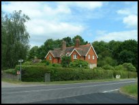 Our Services section is under preparation