| |

|
|
|
| |
 Yalding in Kent is a small village between East Peckham and West Farleigh about
5 miles from Maidstone. Yalding in Kent is a small village between East Peckham and West Farleigh about
5 miles from Maidstone.
Gaeling or Haelling was a Saxon boundary fort settled in the late 400s AD and
was probably built to control the crossing of the medway.
The name is recorded in the Domesday book as the Saxon manor of Hallinges
owned by Aldret, and that it was given to Richard de Tonbridge by
William the Conqueror . The name had changed to
Yaldinge by the time of the civil war (1642 - 1648).
An original Saxon village known as Twyford 'twin ford' was found on the
the point where the Medway and Teise joined. It is believed that flooding
moved the village uphill to its present location. It is probable that the
bridge at Twyford was constructed before Town Bridge, as this was the main
crossing point of the rivers, and would have been impassable when heavy
rain had fallen.
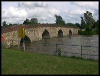
Town bridge, the main crossing point within the current village over the
river Beult is a stone bridge about 450 ft long and was constructed in the
1400's probably on the site of an old wooden structure. This bridge is the
longest surviving medieval bridge in Kent, and is very attractive .
The village does not appear to have been badly hit by the early occurrences
of the Black Death but in 1510 the pestilence claimed half the village.
This Wealden iron industry was important to the area, as Yalding was a
main shipment point for the cannons manufactured at nearby Horsmonden and
other villages, to the naval base at Chatham. The Iron Master John Browne
from Horsmonden shipped most of his cannons from Yalding .
During the Civil War in 1643, a Battle took place at Town Bridge
between the Roundheads and Cavaliers. The Cavaliers had advanced from
Aylesford towards Tonbridge , but the Parliamentarian Soldiers had
marched to block their movements, bombarded them and forced their
surrender. Equipment for about 600 men was seized, but only 300 were
captured, the rest escaping into the Weald.
When the iron industry had declined, the area around Yalding reverted
to its original farming industries, mostly fruit farming with apples and
pears being very common. Yalding was a good shipping point for the fruit
due to its navigable river, the Medway providing access to the sea.
The hop growing industry was also within the area, but declined in the
early 1900's. |
|
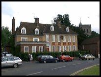
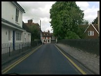
 Yalding in Kent is a very attractive village, with many old buildings to look at. Yalding in Kent is a very attractive village, with many old buildings to look at.
The church has an unusual spire, and the area around the church is worth
visiting, with the old Town Bridge and its long and narrow stone span
providing a picturesque walk over the river. |
|
 Yalding in Kent is a small village with a few shops and facilities, the nearest small
town shopping centre is at Paddock Wood about 5 miles south west. Yalding in Kent is a small village with a few shops and facilities, the nearest small
town shopping centre is at Paddock Wood about 5 miles south west.
The nearest major shopping centre is at Maidstone about 6 miles to the east
which provides major supermarkets and facilities.
There is a train service that runs through the outskirts of the village,
which connects Maidstone to Paddock Wood , providing a regular service, to
the Ashford London line. |
|
| Yalding is shown as the red symbol on the map. |
|
|
Nearby Villages
(click on symbol to see the village page) |
| Village= | |
Town= | |
Recorded in Domesday= |  |
| |
|
|
Boughton Monchelsea |
(Miraculous vision) | | 4.49 miles |
|
|
Coxheath |
(Soldiers and Duels) | | 2.86 miles |
|
|
East Peckham |
(Centre of the Hop Industry) | | 2.07 miles |
|
|
Hadlow |
(Mays Folly - 150ft tower) | | 4.14 miles |
|
|
Linton |
(Cavalier loses House) | | 3.51 miles |
|
|
Marden |
(Broadcloth and Agriculture) | | 4.36 miles |
|
|
Mereworth |
(The First Victoria Cross) | | 3.24 miles |
|
|
Paddock Wood |
(Railway brings prosperity) | | 3.54 miles |
|
|
Tudeley and Capel |
(Iron Industry and Hop Pickers) | | 5.04 miles |
|
|
| Copyright Villagenet 1998-2025 | |
| |
|
|
Local Interest
Just click an image |
|
|
|
|
|
|
|
|
|
|
|
|
|
|
| |