blank

Bonnington in Kent

Google map showing area surrounding Bonnington
(Saint Rumwold the child saint)
Location: 51.079209,0.931478
General Details
Bonnington Kent - The cross roadsBonnington in Kent lies on the B2067 just between Bilsington and Lympne . The church dedicated to St Rumwold is said to be one of the oldest on the Romney Marsh . St Rumwold was a child saint, born in Northampton in the 600's AD the King of Mercia's son, it is said he distinguished himself by preaching his first sermon at Brackley on his second day of life, and dying on his third day.

The land in this area used to be common ground, but it was settled and farming became the local trade.

Bonnington used to be the site of the Leet Court before the times of Elizabeth I.

In 1804 Napoleon was getting ready to invade England, the government decided to try to stop a French invasion via the Romney Marshes and they built the Royal Military Canal as part of the nations defenses.

It was re-fortified in the 1940's by installing gun emplacements and pill boxes to try to delay a German invasion via the Marshes, the canal runs alongside Bonnington near to the church .

The Aldington Gang of smugglers in the 1820's came from Aldington about 1 mile inland, and the area was one of the main routes for the goods to come in to Aldington from the Marshes. It is likely that St Rumwolds church was used to store the contraband.
Views
Bonnington Kent - St Rumwolds church
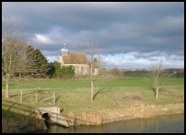
Bonnington in Kent is glimsed as you pass by on the B2067, it is a small quiet village.

If you turn towards Newchurch at the village crossroads and travel about 1 mile you come to St Rumwolds church and the Royal Military Canal which is quite deserted and has gorgeous views across the Romney Marsh .
Services
Bonnington Kent - The villageBonnington in Kent has no local services except for the church which lies about 1 mile from the village on the edge of the Romney Marsh .

The main shopping centre is at Ashford about 7 miles north west which has all the services including trains and Eurostar .
Map
Bonnington is shown as the red symbol on the map.

Nearby Villages

(click on symbol to see the village page)
Village= Town= Recorded in Domesday=
Aldington (The Aldington Gang)
1.05 miles
Appledore (Danes invade England)
7.06 miles
Bilsington (The Priory and Obelisk)
0.99 miles
Burmarsh (The fortress in the Marsh?)
3.77 miles
Dymchurch (The Romans and the sea wall)4.56 miles
Hamstreet and Orlestone (The Start of the Ordnance Survey)3.68 miles
Kenardington (Danes destroy Saxon Fort)5.41 miles
Lympne (From Roman Castle to Tigers)
4.12 miles
Mersham (Founder of Ashford Grammar School)
2.78 miles
Newchurch (The Church Tower with a kink)2.36 miles
Ruckinge (Smuggling and Traction Engines)
2.11 miles
Sellindge (Oliver Cromwells Horse)
3.79 miles
Sevington (Saxons and Dual Carriageway)
3.55 miles
Smeeth (The Scott Family)3.06 miles
Snargate (Sluice Gates made by Royal Order)5.66 miles
Snave (the Remote church)4.13 miles
Warehorne (A good place to explore the Marshes)
4.32 miles
Woodchurch (Dragoons capture Smugglers)6.79 miles
Copyright Villagenet 1998-2024
 
Local Businesses
Talk in Code fabulous new Album
Battle Brewery our local excellent micro brewery
The Bald Explorer for local documentaries
The Rudes as lots of people call us, are an outdoor touring theatre company specialising in taking new & original theatre to mainly small rural communities and a few towns across the South of England. We were founded in 1998 & first toured in the Summer of 1999. Currently we tour only in the summer performing 50+ times nightly during June, July & August. https://therudemechanicaltheatre.co.uk
Tenderheart Childrens Charity
For all things mosaic, commissions workshops etc please contact Hannah