| |

|
|
|
| |
 Bilsington in Kent lies on the B2067 Tenterden to Hythe road, just north
of the Romney Marsh . Bilsington in Kent lies on the B2067 Tenterden to Hythe road, just north
of the Romney Marsh .
It was a Saxon village first recorded as Bilsvitone in the Domesday Book 1086 .
In 1253 a priory of Austin Canons was built next to the church,
it was founded by Sir John Mansell a priests son who councelled
Henry III. The barons in 1272 evicted Sir John and gave the lands
to the son of Simon de Montfort . It was abandoned at Henry VIII's
dissolution of the monastries in 1538 .
The old building had a moat all round, and this can still be seen
with the ancient farmhouse that replaced the monastry still in
place. This farmhouse was reputed to be one of the hiding places
for the local Aldington Gang in the 1820's.
In 1804 Napoleon was getting ready to invade England, the government
decided to try to stop a French invasion via the Romney Marshes and
they built the Royal Military Canal as part of the nations defenses.
It was re-fortified in the 1940's by installing gun emplacements and
pill boxes to try to delay a German invasion via the Marshes, the
canal runs alongside Bislington .
In 1825 Sir William Cosway purchased the priory estate. He was
a politician who was very interested in the plight of the farm
labourers (see also Swing Riots ), and in 1830 paid the sum of
£150 to help 4 Bilsington families to emigrate to America ,
he also built the school. On 10th June 1834 her was on the
London to Brighton coach when it turned over and he was killed,
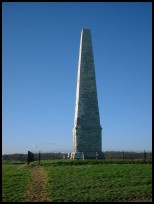
as a memorial, his family built an obelisk 52 ft high.
The obelisk was struck by lightning in 1967 and has recently
been restored to its former glory.
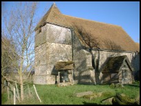
The church shows a fine example of a hatchment of Lord Luxmoor
dating from 1945. |
|
 Bilsington in Kent is just above the level of the Romney Marsh , and has fine
views across the vast landscape, it is peaceful and beautiful during
hot summer days. Bilsington in Kent is just above the level of the Romney Marsh , and has fine
views across the vast landscape, it is peaceful and beautiful during
hot summer days.
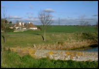
The Royal Military Canal runs along the southern edge of the village
and is popular with walkers and fishermen. |
|
 Bilsington in Kent is a small village with a public house and church,
the nearest shops are at Ham Street about 3 miles west. Bilsington in Kent is a small village with a public house and church,
the nearest shops are at Ham Street about 3 miles west.
Trains can be caught at Hamstreet about 2 miles east, and the major
shopping in the area is to be found at Ashford about 6 miles north,
where the main London trains can be found. |
|
| Bilsington is shown as the red symbol on the map. |
|
|
Nearby Villages
(click on symbol to see the village page) |
| Village= | |
Town= | |
Recorded in Domesday= |  |
| |
|
|
Aldington |
(The Aldington Gang) | | 1.94 miles |
|
|
Appledore |
(Danes invade England) | | 6.07 miles |
|
|
Bonnington |
(Saint Rumwold the child saint) | | 0.99 miles |
|
|
Burmarsh |
(The fortress in the Marsh?) | | 4.37 miles |
|
|
Dymchurch |
(The Romans and the sea wall) | | 4.96 miles |
|
|
Hamstreet and Orlestone |
(The Start of the Ordnance Survey) | | 2.77 miles |
|
|
Kenardington |
(Danes destroy Saxon Fort) | | 4.42 miles |
|
|
Lympne |
(From Roman Castle to Tigers) | | 5.03 miles |
|
|
Mersham |
(Founder of Ashford Grammar School) | | 3.31 miles |
|
|
Newchurch |
(The Church Tower with a kink) | | 2.19 miles |
|
|
Ruckinge |
(Smuggling and Traction Engines) | | 1.12 miles |
|
|
Sellindge |
(Oliver Cromwells Horse) | | 4.77 miles |
|
|
Sevington |
(Saxons and Dual Carriageway) | | 3.77 miles |
|
|
Smeeth |
(The Scott Family) | | 3.84 miles |
|
|
Snargate |
(Sluice Gates made by Royal Order) | | 4.76 miles |
|
|
Snave |
(the Remote church) | | 3.28 miles |
|
|
Stone in Oxney |
(Roman stone altar) | | 7.52 miles |
|
|
Warehorne |
(A good place to explore the Marshes) | | 3.33 miles |
|
|
Woodchurch |
(Dragoons capture Smugglers) | | 5.86 miles |
|
|
| Copyright Villagenet 1998-2025 | |
| |
|
|
Local Interest
Just click an image |
|
|
|
|
|
|
|
|
|
|
|
|
|
|
| |