| |

|
|
|
| |
 Wittersham in Kent can be found on the B2082, four and a half miles south of Tenterden . Wittersham in Kent can be found on the B2082, four and a half miles south of Tenterden .
It stands high in the middle of the Isle of Oxney, which was once an
island surrounded by sea water.
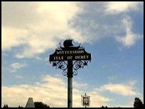
The village sign shows an image of a longship, which refers back to
the Danish invasion of Appledore in 892. It is very likely that the
Danes occupied the Isle of Oxney, as a vantage point to view the
troops of King Alfred the Great who it is believed were based at
Newenden .
In 1032, the manor of Wittersham was given with the consent of King
Canute, to the church of Christ, Canterbury. Later it was assigned by
licence to the Master and Fellows of All Saints College, Maidstone.
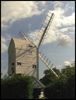
Stocks Mill a beautiful post mill was built about 1781, but it is
possible that the mill was originally located elsewhere. The mill
was operated for 120 years, but towards the end of the last century,
the demand for locally milled flour declined, and that for factory
ground increased.
The mill stopped production around the turn of this century. It has been
restored, and is now open on Sundays, and Bank Holidays 2.30 - 5.00
from May to September.
The village school was founded in 1820, by William Cornwallis and
his wife in memory of their grandson. William Cornwallis was Rector
of Wittersham for 50 years.
During the First World War, there was a mooring site for Airships in
Wittersham.
If you travel about 1 mile away from the village on the Rolvenden
road you find the small station of Wittersham Road with its
Steam Trains . This is on the Kent and East Sussex Railway, with trains
travelling to Tenterden , Northiam and also to the castle at Bodiam . |
|
 Wittersham in Kent has some very pretty views all round if you travel to the
edges of the Isle of Oxney . Wittersham in Kent has some very pretty views all round if you travel to the
edges of the Isle of Oxney .
The church and surrounding area is quite old, and attractive.
Stocks Mill is well worth visiting, as the restoration of the mill
is to a high standard, and is open frequently through the summer.
Don't forget, the Kent and East Sussex Railway Steam Trains run
about 1 mile away from the village at Wittersham Road which can
be found on the road to Rolvenden , this is a fabulous place to
have a picnic. |
|
 There are few local services, and the main shopping centre is in Tenterden
to the north, or Rye to the West. There are few local services, and the main shopping centre is in Tenterden
to the north, or Rye to the West.
The nearest trains run across the Romney Marsh from Hastings to Ashford ,
and can be caught at Appledore . |
|
| Wittersham is shown as the red symbol on the map. |
|
|
Nearby Villages
(click on symbol to see the village page) |
| Village= | |
Town= | |
Recorded in Domesday= |  |
| |
|
|
Appledore |
(Danes invade England) | | 4.00 miles |
|
|
Beckley |
(Alfred the Great and Guns !) | | 3.29 miles |
|
|
Benenden |
(One of Englands Top Girls Schools) | | 6.56 miles |
|
|
Brenzett |
(St Eanswyth a saxon princess) | | 6.59 miles |
|
|
Brookland |
(13th century wooden spire) | | 5.83 miles |
|
|
East Guldeford |
(Barn-like Church) | | 4.26 miles |
|
|
Ewhurst Green |
(Great Fire of London contributions) | | 6.63 miles |
|
|
Fairfield |
(The Isolated Church) | | 4.15 miles |
|
|
Iden |
(Sheriff of Kent and Jack Cade) | | 2.29 miles |
|
|
Kenardington |
(Danes destroy Saxon Fort) | | 5.81 miles |
|
|
Newenden |
(Alfred the Great's Fort) | | 3.91 miles |
|
|
Northiam |
(Prime Ministers D Day inspection) | | 4.67 miles |
|
|
Peasmarsh |
(Black Death moves village) | | 2.54 miles |
|
|
Playden |
(Saltcote and fish) | | 3.26 miles |
|
|
Rolvenden |
(Witches stealing Holy Water) | | 4.22 miles |
|
|
Sandhurst |
(Escape from the Great Plague) | | 6.24 miles |
|
|
Smallhythe |
(The Ellen Terry Museum) | | 1.89 miles |
|
|
Snargate |
(Sluice Gates made by Royal Order) | | 5.99 miles |
|
|
Stone in Oxney |
(Roman stone altar) | | 2.68 miles |
|
|
Warehorne |
(A good place to explore the Marshes) | | 6.75 miles |
|
|
| Copyright Villagenet 1998-2025 | |
| |
|
|
Local Interest
Just click an image |
|
|
|
|
|
|
|
|
|
|
|
|
|
|
| |