| |

|
|
|
| |
 Old Romney in Kent sat on a small island in the Rother estuary , which originally
ran from Appledore through to the sea near nowadays Greatstone . It now lies
just off the busy Brenzett to New Romney road. The village gave its name to
the area of the Romney Marshes , probably because it was the major village
in the area. The village was also known as Vetus Rumunellum, Veteri Rumenal,
Old Romenal and Old Romney. Old Romney in Kent sat on a small island in the Rother estuary , which originally
ran from Appledore through to the sea near nowadays Greatstone . It now lies
just off the busy Brenzett to New Romney road. The village gave its name to
the area of the Romney Marshes , probably because it was the major village
in the area. The village was also known as Vetus Rumunellum, Veteri Rumenal,
Old Romenal and Old Romney.
In 791 King Offa granted a court to Romney, possibly heralding in the start
of the Cinque Ports , and at the time it was a prosperous fishing and trading
port.
Old Romney and New Romney were linked, with the port at New Romney moving
further away from the old town as the coastline spread into the
English Channel. This creeping away of the harbour continued, until the
1100's when the distance between Romney and its harbour became too great,
and the two villages separated. The Cinque Ports first mentioned in a Royal
Charter of 1155 originally consisted of the 'Ports' of Hastings , New Romney ,
Hythe , Dover and Sandwich , so we know that Old Romney had been superceeded by
this time.
The decline of Old Romney started at this point, but the natives continued
to reclaim the land from the Rother Estuary and the marshland to provide rich
and fertile farmland .
Old Romney reverted to a farming community , providing sheep and wool for
the wool industry in Flanders . Around 1300 Edward I set up a customs duty
on the export of english wool, which was in great demand in Europe. This was
the first permanent customs system established in England, and until it was
set up all trade in and out of England was free. Up to this point Old Romney
was shipping most of its wool abroad from its harbour at New Romney . The trade
continued after customs were set, and much wool was shipped out of the country
with a return traffic of brandy and tobacco.
1614 the export of all wool was made illegal, so the smugglers became more
violent and with the introduction of the death penalty in 1661 most became
armed. In 1698 the government decided to take action. An Act was passed
stopping people within 15 miles of the sea from buying any wool, unless they
guaranteed that they wouldn't sell it to anyone within 15 miles of the sea.
Also any farmers within 10 miles of the sea had to account for their fleeces
within 3 days of shearing, all of this effected Old Romney .
With the decline in smuggling in the 1730's the area continued to be a farming
centre, the number of people declined until today when there is only the church
and a handfull of houses to mark the village.
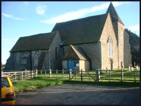
St Clement at Old Romney is one of those churches supported by the
Romney Marsh Historic Churches Trust . |
|
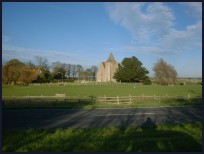
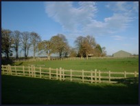
 Old Romney in Kent nowadays consists of a church and a few houses in an area right
in the centre of the Romney Marshes, it is very picturesque if you can take
time to drive off the fast Brenzett to New Romney road. Old Romney in Kent nowadays consists of a church and a few houses in an area right
in the centre of the Romney Marshes, it is very picturesque if you can take
time to drive off the fast Brenzett to New Romney road.
The church is most unusual with the pews being painted pink, and here you
get the feel for the times of the smugglers. The pink church decorations
were made by the film crew of Dr Syn(the Scarecrow) in 1963. |
|
 Old Romney in Kent has no services, and the nearest shops are in New Romney, about 2
miles south.
The nearest trains run from Appledore station about 4 miles to the north. Old Romney in Kent has no services, and the nearest shops are in New Romney, about 2
miles south.
The nearest trains run from Appledore station about 4 miles to the north. |
|
| Old Romney is shown as the red symbol on the map. |
|
|
Nearby Villages
(click on symbol to see the village page) |
| Village= | |
Town= | |
Recorded in Domesday= |  |
| |
|
|
Appledore |
(Danes invade England) | | 5.52 miles |
|
|
Brenzett |
(St Eanswyth a saxon princess) | | 2.26 miles |
|
|
Brookland |
(13th century wooden spire) | | 2.71 miles |
|
|
Burmarsh |
(The fortress in the Marsh?) | | 6.07 miles |
|
|
Camber |
(Sands and Holidays) | | 5.76 miles |
|
|
Dymchurch |
(The Romans and the sea wall) | | 5.26 miles |
|
|
East Guldeford |
(Barn-like Church) | | 6.51 miles |
|
|
Fairfield |
(The Isolated Church) | | 4.39 miles |
|
|
Greatstone |
(Parabolic Sound Detectors and PLUTO) | | 3.56 miles |
|
|
Ivychurch |
(The burial ground on the Island) | | 1.58 miles |
|
|
Littlestone |
(The Genteel Resort) | | 2.92 miles |
|
|
Lydd |
(The Cathedral of the Marsh) | | 2.79 miles |
|
|
Lydd on Sea |
(Bungalows and Fishermen) | | 4.53 miles |
|
|
Newchurch |
(The Church Tower with a kink) | | 4.12 miles |
|
|
New Romney |
(Cinque Port and Storm) | | 1.96 miles |
|
|
Playden |
(Saltcote and fish) | | 6.56 miles |
|
|
Rye Harbour |
(Nature Reserve and unspoilt beaches) | | 6.86 miles |
|
|
Snargate |
(Sluice Gates made by Royal Order) | | 3.29 miles |
|
|
Snave |
(the Remote church) | | 3.25 miles |
|
|
St Mary in the Marsh |
(Ancient Celts) | | 2.68 miles |
|
|
St Marys Bay |
(Holidays and Beaches) | | 3.86 miles |
|
|
Stone in Oxney |
(Roman stone altar) | | 6.04 miles |
|
|
| Copyright Villagenet 1998-2025 | |
| |
|
|
Local Interest
Just click an image |
|
|
|
|
|
|
|
|
|
|
|
|
|
|
| |