| |

|
|
|
| |
 Sellindge in Kent lies between Smeeth and Hythe on the A20 , it
is a long village stretching from Stone Hill to Sellindge Lees . Sellindge in Kent lies between Smeeth and Hythe on the A20 , it
is a long village stretching from Stone Hill to Sellindge Lees .
The Domesday Book names Sellindge as Sedlinges with two churches
a mill , 36 acres of meadow, and a wood for 6 pigs. It is known
that William the Conqueror gave the four local manors to
Hugo de Montford .
The village as it was inland from Aldington became a distribution
point for smuggled goods , and The Whitehall was used for storage.
1556 Thomas Hudson was arrested and taken to Canterbury on suspicion
of heresy with 14 other protestants , 5 of the protestants starved
to death but Thomas was burned at the stake in Barton Fields .
In the mid 1650's Oliver Cromwell is recorded as having his horse
re-shoed at Stone Hill smithy in the village, he paid 4d.
1840 brought the London to Dover railway line into the area, and
a station was planned for Sellindge, but the local traders objected
and the station was built at Westenhanger. Some time later the
tradesmen realised that the railway was bringing business and asked
for a halt in the village, but this was turned down.
In one map from 1842 there were 40 acres of hops being harvested
and still many oast houses remain around the area.
At the end of the 1800's Sellindge Lees , the village common was
reclaimed and the modern A20 was built through it. |
|
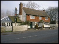
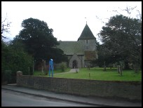
 Sellindge in Kent is a long straggling village with a few very pretty
areas off the main road. Sellindge in Kent is a long straggling village with a few very pretty
areas off the main road. |
|
 Sellindge in Kent has a few local services, but is only a few miles from
Hythe in the south and Ashford in the north west. Sellindge in Kent has a few local services, but is only a few miles from
Hythe in the south and Ashford in the north west.
Ashford about 6 miles north west, provides a major shopping centre,
supermarkets and the main line station to London , Paris and Brussels . |
|
| Sellindge is shown as the red symbol on the map. |
|
|
Nearby Villages
(click on symbol to see the village page) |
| Village= | |
Town= | |
Recorded in Domesday= |  |
| |
|
|
Aldington |
(The Aldington Gang) | | 2.92 miles |
|
|
Bilsington |
(The Priory and Obelisk) | | 4.77 miles |
|
|
Bonnington |
(Saint Rumwold the child saint) | | 3.79 miles |
|
|
Burmarsh |
(The fortress in the Marsh?) | | 4.01 miles |
|
|
Lympne |
(From Roman Castle to Tigers) | | 2.18 miles |
|
|
Mersham |
(Founder of Ashford Grammar School) | | 3.43 miles |
|
|
Ruckinge |
(Smuggling and Traction Engines) | | 5.89 miles |
|
|
Sevington |
(Saxons and Dual Carriageway) | | 4.66 miles |
|
|
Smeeth |
(The Scott Family) | | 2.33 miles |
|
|
| Copyright Villagenet 1998-2025 | |
| |
|
|
Local Interest
Just click an image |
|
|
|
|
|
|
|
|
|
|
|
|
|
|
| |