| |

|
|
|
| |
 Tenterden in Kent lies on the border of the dense woodlands of the Weald, and
the flatter farmlands of the Rother Levels, that run down to the
Romney Marshes.
In earlier times it was known as 'Tenet ware den', meaning, 'pig-pasture
of the men of Thanet'. However it was sheep that made the area prosperous. Tenterden in Kent lies on the border of the dense woodlands of the Weald, and
the flatter farmlands of the Rother Levels, that run down to the
Romney Marshes.
In earlier times it was known as 'Tenet ware den', meaning, 'pig-pasture
of the men of Thanet'. However it was sheep that made the area prosperous.
In 1331 the export of unwashed wool was prohibited by King Edward III. He
encouraged Flemish weavers to settle here, thus bringing their
weaving and dying techniques to England. Tenterden and some of its
neighbouring villages soon became an important centre of the Broadcloth
manufacturing industry.
Smallhythe and Reading Street , just out of Tenterden , provided access
to the sea. These two small ports were founded to transport lumber from
the Wealden Forests. However the 14th Century Smallhythe had a well
established boat building industry.
At the heart of Tenterden can be found the beautiful old church of
St Mildred, whose records date from 1180. It has a finely carved wooden
ceiling which dates from the 15th Century, and a tower made of Bethersden
marble.
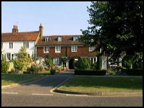
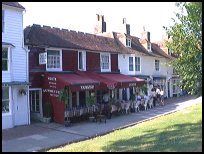
Tenterden's High Street features a wealth of historic shops and houses
dating from the 15th to 18th centuries, many with their original facades.
Tenterden Station is a must for Steam Train enthusiasts. The Kent and
East Sussex Railway runs steam trains along a seven mile stretch of
track through the beautiful countryside from Tenterden to Northiam .
During the early part of the year 2000, the line was opened as
far as Bodiam , with its magnificent castle.
A few minutes walk away from the station, in Station Road can be found
Tenterden Museum, housed in a two storey weatherboard building. This
building is the last once common industrial building from the 19th
century. The museum houses displays relating to hop-picking, farming,
the Cinque Ports , and Victorian domestic life, all illustrating the
history of Tenterden and the surrounding area. |
|
 Tenterden in Kent is on the top of a hill, and the church tower can be seen
on all routes into the town.
The town boasts the main terminus of the Kent and East Sussex Railway ,
which takes steam train passengers to Northiam , and to
Bodiam with its castle. Tenterden in Kent is on the top of a hill, and the church tower can be seen
on all routes into the town.
The town boasts the main terminus of the Kent and East Sussex Railway ,
which takes steam train passengers to Northiam , and to
Bodiam with its castle.
On the road down to the station, lies the museum, which shows the
history of the town.
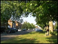
The main high street has a wide feel to it, the tree lined road
with shops to the side have a european feel to them. |
|
 Tenterden in Kent is the main town in the area, and provides much of what
is required. Tenterden in Kent is the main town in the area, and provides much of what
is required.
The nearest large town is Ashford about 14 miles north east, which
provides access to the M20 Dover to London motorway.
The nearest trains are from Ashford , with a very frequent service
to London.
Tenterden is on the main Hastings to Ashford bus route. |
|
| Tenterden is shown as the red symbol on the map. |
|
|
Nearby Villages
(click on symbol to see the village page) |
| Village= | |
Town= | |
Recorded in Domesday= |  |
| |
|
|
Appledore |
(Danes invade England) | | 5.04 miles |
|
|
Benenden |
(One of Englands Top Girls Schools) | | 4.69 miles |
|
|
Biddenden |
(The Maids of Biddenden) | | 3.75 miles |
|
|
Cranbrook |
(Christmas Cards and Union Mill) | | 6.86 miles |
|
|
Kenardington |
(Danes destroy Saxon Fort) | | 5.40 miles |
|
|
Newenden |
(Alfred the Great's Fort) | | 4.98 miles |
|
|
Rolvenden |
(Witches stealing Holy Water) | | 2.86 miles |
|
|
Sandhurst |
(Escape from the Great Plague) | | 6.25 miles |
|
|
Sissinghurst |
(The magnificent garden of Vita Sackville-West) | | 6.27 miles |
|
|
Smallhythe |
(The Ellen Terry Museum) | | 2.22 miles |
|
|
Snargate |
(Sluice Gates made by Royal Order) | | 7.34 miles |
|
|
Stone in Oxney |
(Roman stone altar) | | 4.88 miles |
|
|
Warehorne |
(A good place to explore the Marshes) | | 6.57 miles |
|
|
Woodchurch |
(Dragoons capture Smugglers) | | 3.82 miles |
|
|
| Copyright Villagenet 1998-2025 | |
| |
|
|
Local Interest
Just click an image |
|
|
|
|
|
|
|
|
|
|
|
|
|
|
| |