| |

|
|
|
| |
 Paddock Wood in Kent lies in the Medway valley, on the fertile weald,
between Maidstone about 10 miles north east and Tunbridge Wells
about 6 miles to the south west. Paddock Wood in Kent lies in the Medway valley, on the fertile weald,
between Maidstone about 10 miles north east and Tunbridge Wells
about 6 miles to the south west.
Its fortunes have grown up from the railway line that was built
during the mid 1800's, which provided transport to the Towns and
Cities for the local produce. Prior to the railway, the goods
were shipped from Yalding and East Peckham by barge down the
Medway to the sea.
The town is now the centre for the distribution of fruit and
vegetables in the area to and from europe, with its vast air
conditioned warehousing and distribution facilities.
It is also a commuter town, with much of its population travelling
daily by train to the City of London to work. |
|
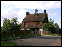
 To the south of the village are the hills rising to Brenchley . To the south of the village are the hills rising to Brenchley .
In the far distance are the hills near East Peckhamn , and all
around is the attractive farmland of the Weald , with its hop
gardens and many Oast houses . |
|
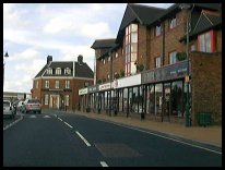
 Paddock Wood in Kent is the centre of the villages in this part of the Weald,
and has a wide range of shops and facilities. Paddock Wood in Kent is the centre of the villages in this part of the Weald,
and has a wide range of shops and facilities.
The main line train service from Dover to London passes through
the village, providing a quick and frequent service to London.
Busses pass throught the village from Royal Tunbridge Wells to
Maidstone . |
|
| Paddock Wood is shown as the red symbol on the map. |
|
|
Nearby Villages
(click on symbol to see the village page) |
| Village= | |
Town= | |
Recorded in Domesday= |  |
| |
|
|
Boughton Monchelsea |
(Miraculous vision) | | 7.36 miles |
|
|
Brenchley |
(A beautiful Kent village) | | 2.34 miles |
|
|
Coxheath |
(Soldiers and Duels) | | 5.96 miles |
|
|
East Peckham |
(Centre of the Hop Industry) | | 2.16 miles |
|
|
Hadlow |
(Mays Folly - 150ft tower) | | 3.62 miles |
|
|
Horsmonden |
(The largest Wealden Iron Works) | | 3.54 miles |
|
|
Linton |
(Cavalier loses House) | | 6.22 miles |
|
|
Marden |
(Broadcloth and Agriculture) | | 4.64 miles |
|
|
Matfield |
(Largest Village Green in Kent) | | 2.43 miles |
|
|
Pembury |
(The ghost of Hawkwell) | | 3.39 miles |
|
|
Rusthall |
(The Toad Rock) | | 7.46 miles |
|
|
Tudeley and Capel |
(Iron Industry and Hop Pickers) | | 2.04 miles |
|
|
Yalding |
(longest medieval bridge in Kent) | | 3.54 miles |
|
|
| Copyright Villagenet 1998-2025 | |
| |
|
|
Local Interest
Just click an image |
|
|
|
|
|
|
|
|
|
|
|
|
|
|
| |